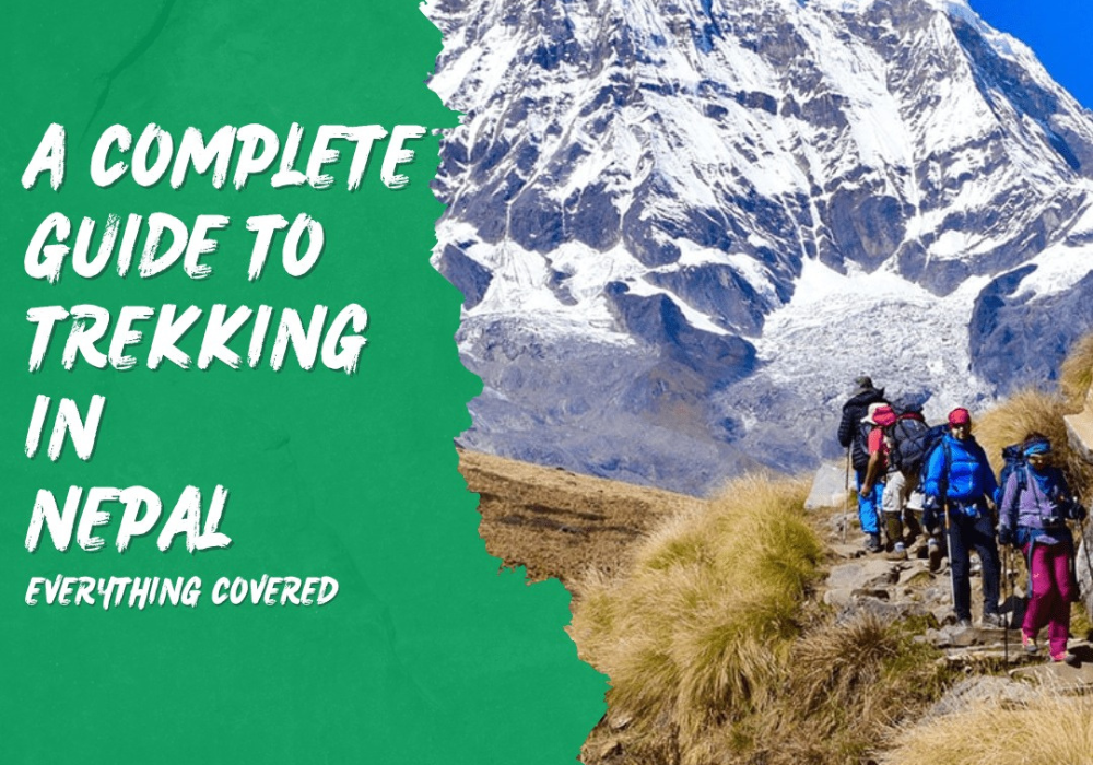
Nepal sits at the heart of the Himalayas, where eight of the world's fourteen highest peaks pierce the sky. For decades, trekkers from every corner of the globe have made the journey here, drawn by snow-capped mountains, ancient monasteries, and trails that wind through villages where life moves to a different rhythm. If you want to reach Everest Base Camp, cross mountain passes, or walk forest trails lined with prayer flags, Nepal offers unmatched trekking experiences.
The numbers tell part of the story; Mount Everest, Kanchenjunga, Lhotse, Makalu, Cho Oyu, Dhaulagiri, Manaslu, and Annapurna I all rise from Nepali soil. One reason Nepal stands out is the easy access to its highest peaks. You don't need mountaineering skills or expedition-level budgets to walk beneath them. Thanks to Nepal’s long-established teahouse network, you can trek for weeks with only a daypack, staying in basic lodges and eating warm meals along the way. You'll share trails with yak caravans, pass
spinning prayer wheels in Buddhist villages, and wake to views that belong on postcards.
From Kathmandu’s busy streets to the quiet mountain passes, Nepal offers rich rewards to those who prepare well. While altitude, weather, and isolation make the trails challenging, they remain within reach for anyone who trains and paces themselves.
This guide gives you everything you need to plan and complete a successful trek in Nepal. This guide explains how Nepal’s main trekking regions vary in terrain, difficulty, and accessibility. We'll walk through the most popular routes in detail, covering what to expect each day, how long they take, and who they suit best. You'll understand when to go, what permits you need, how to handle altitude safely, and what gear to pack. This guide covers trail life, cultural etiquette, environmental care, and how to get to and from the trek.
Whether this is your first multi-day trek or you're a seasoned hiker looking to explore new regions, this guide will help you make informed decisions and set realistic expectations. Nepal's mountains have a way of changing people but only if you approach them with preparation, patience, and respect.
Best Trekking Regions in Nepal
Each trekking region in Nepal offers a unique experience. Some regions are busy and developed, while others are remote and untouched. Some treks take several weeks; others fit into a short vacation. To choose the right region for trekking in Nepal, first decide what matters most to you; scenic views like Everest, cultural stops such as Buddhist villages, peaceful trails, tough climbs, or easy access.
Quick Comparison of Nepal's Main Trekking Regions:
|
Region |
Typical Treks |
Difficulty |
Highlights |
Best Seasons |
Permit Notes |
|
Everest/Khumbu |
EBC, Gokyo Lakes, Three Passes |
High |
Everest views, Sherpa culture, high altitude |
Spring, Autumn |
Sagarmatha National Park permit, TIMS |
|
Annapurna |
Annapurna Circuit, ABC, Poon Hill |
Moderate to High |
Diverse landscapes, easier access, Pokhara base |
Spring, Autumn |
ACAP, TIMS |
|
Langtang |
Langtang Valley, Kyanjin Gompa |
Moderate |
Close to Kathmandu, valley scenery |
Spring, Autumn |
Langtang National Park permit, TIMS |
|
Manaslu |
Manaslu Circuit |
High |
Remote, fewer crowds, traditional villages |
Spring, Autumn |
Restricted area permits, guide required |
|
Upper Mustang |
Lo Manthang trek |
Moderate |
Tibetan culture, desert landscapes, caves |
Spring, Autumn, Monsoon |
Restricted area permits, high fees |
|
Dolpo |
Shey Phoksundo routes |
Very High |
Ultra-remote, camping treks, wilderness |
Spring, Autumn |
Restricted area permits, expensive |
Everest and Annapurna are the most popular regions, with strong infrastructure and easy-to-book routes, whether you go solo or with a guide. Langtang is quieter but still has decent facilities. Manaslu, Mustang, and Dolpo need more preparation, higher costs, and in some cases, a registered guide. In return, they offer quieter trails and more remote, untouched landscapes.
Everest / Khumbu Region:
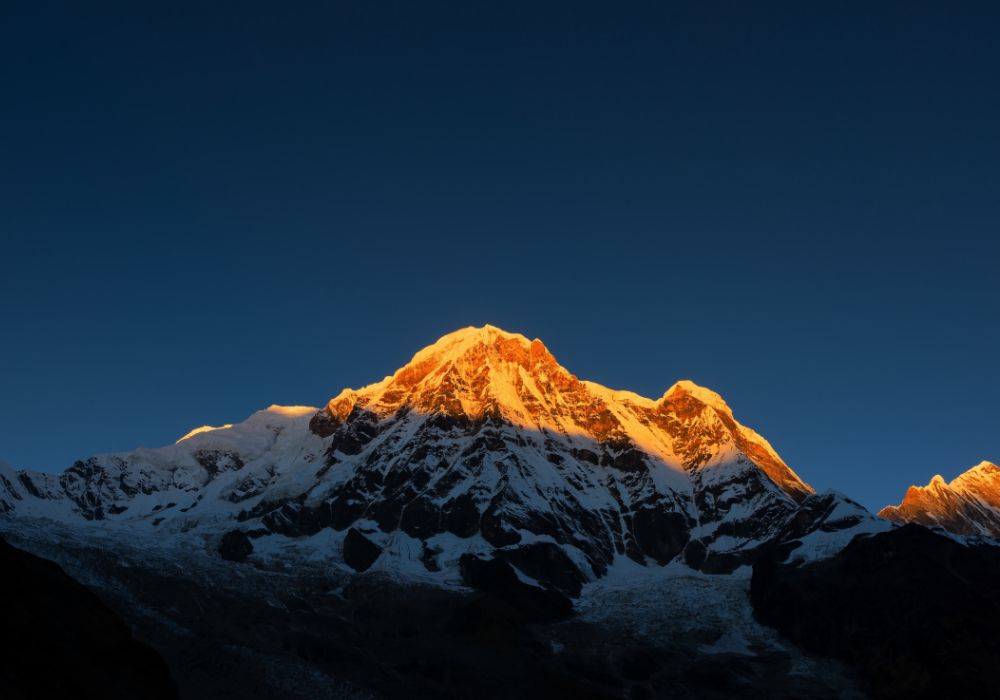
The Khumbu / Everest region, home to Mount Everest and the Sherpa community, is Nepal’s most iconic trekking destination. Its scenery includes massive glaciers, sheer cliffs, and towering peaks even at 5,000 meters, the mountains still feel impossibly high.
Classic Treks: EBC, Gokyo, and the Three Passes
Most trekkers visit Khumbu for the Everest Base Camp trek, a popular two-week route from Lukla to the base of the world’s highest mountain. The Gokyo Lakes trek is a quieter option, featuring turquoise glacial lakes and views from Gokyo Ri. For experienced hikers, the Three Passes route is a challenging three-week loop that crosses Kongma La, Cho La, and Renjo La.
What to Expect: Altitude, Views, and Villages
Treks in the Khumbu begin with a dramatic flight into Lukla, where planes land on a short, uphill runway built into the mountainside. From there, the trail climbs through Sherpa villages such as Namche Bazaar; the region’s main hub and Tengboche, known for its monastery with Ama Dablam rising behind it. Altitude is a major factor, with most routes reaching 5,000 meters or more, so proper acclimatization is essential. In return, trekkers get close-up views of Everest, Lhotse, and Ama Dablam, visits to active monasteries, and insight into Sherpa life in extreme conditions.
This region is best for fit trekkers who can manage high altitude and cold nights, even during the main season. The trail is well-supported by teahouses, but the elevation gain requires a slow and careful pace.
Annapurna Region:
The Annapurna region offers some of Nepal’s most varied trekking, with routes passing from warm valleys and rhododendron forests to high mountain passes all within a few days. Unlike the Everest region, Annapurna is accessible by road from Pokhara, which makes logistics easier. Its wide choice of treks, from short circuits to longer high-altitude routes, appeals to both beginners and experienced trekkers.
Classic Routes: Annapurna Circuit and ABC
The Annapurna Circuit was originally a full loop around the Annapurna massif, crossing Thorong La Pass at 5,416 meters. Due to road construction, many trekkers now skip the lower, road-accessible sections and focus on the more remote high-altitude parts of the route. The Annapurna Base Camp trek leads into the Annapurna Sanctuary, a natural bowl surrounded by peaks like Annapurna I and the sacred Machhapuchhre. For shorter options, Poon Hill (3–4 days) and Mardi Himal (5–7 days) are great introductions to Himalayan trekking and require less time.
Why Base Yourself in Pokhara
Pokhara, Nepal’s second-largest tourism center, offers a calmer setting than Kathmandu. Located beside Phewa Lake with views of the Annapurna range on clear mornings, it serves as a convenient base before and after treks. The Lakeside area has many gear shops, trekking agencies, restaurants, and guesthouses. Most Annapurna treks start and finish here, with jeep transport to the trailheads. Its laid-back atmosphere and strong infrastructure make trip planning simpler than in more remote regions.
Langtang Valley Region:
Langtang Valley Region may not be as well-known as Everest or as varied as Annapurna, but it offers excellent Himalayan trekking just a day’s drive from Kathmandu. The trail begins in a valley that gradually opens into alpine landscapes, with 7,000-meter peaks, glaciers, and Tamang villages rooted in tradition.
Close-to-Kathmandu Alpine Scenery
The 2015 earthquake caused major damage in Langtang Valley, especially in Langtang village. Local communities have since rebuilt, and tourism now plays an important role in their recovery. Trekking here directly supports those efforts.
The Langtang Valley trek typically takes 7–10 days, starting from Syabrubesi and passing through forests home to red pandas, though sightings are rare before reaching Kyanjin Gompa at 3,870 meters. From this village and monastery, you can hike to Kyanjin Ri or Tserko Ri for wide mountain views. Along the trail, you'll pass yak pastures, prayer flags, and glacial streams, all with fewer trekkers than in Everest or Annapurna. This trek is a good option for those with limited time or anyone looking to try a shorter route before attempting a longer one.
Manaslu Region:
The Manaslu region appeals to trekkers looking for a quieter, more remote experience than the busy Annapurna trails. Dominated by Manaslu, the world’s eighth-highest peak, the area offers a challenging circuit trek that has become a popular alternative to the Annapurna Circuit.
A Quieter Circuit Trek With Restricted Permits
Manaslu is a restricted trekking area, so you must travel with a registered guide and obtain additional permits beyond the standard TIMS card. These rules limit visitor numbers and help ensure tourism revenue supports local communities.
The full circuit takes 14–18 days and includes a crossing of Larke Pass at 5,106 meters, a challenging but less crowded alternative to Thorong La. The trail moves through a range of landscapes and cultures, starting with terraced farms and Hindu villages in the lower sections, and leading to Tibetan Buddhist communities in the higher valleys.
Teahouses are available along the route, but they are more basic than those in the Everest or Annapurna regions. You’ll encounter fewer trekkers, more traditional village life, and a greater sense of remoteness. This trek is ideal for experienced hikers who want a quieter circuit and are comfortable with the extra permit requirements.
Mustang Region:
Mustang Region is unlike the lush, monsoon-fed regions of southern Nepal. Sheltered by the Annapurna and Dhaulagiri ranges, it receives little rain and features dry, high-altitude terrain. The area's culture and architecture are closely tied to Tibetan traditions rather than those of central Nepal.
Lo Manthang and Tibetan-Influenced Culture
The trek to Lo Manthang the ancient walled capital of the former Kingdom of Lo passes through deep valleys, wind-carved cliffs, and villages where Tibetan Buddhist culture shapes daily life. Local architecture, language, and customs reflect centuries of Tibetan influence. Along the way, you'll see monasteries with historic murals, chortens on ridgelines, and striking red and gray cliffs under wide blue skies.
Upper Mustang requires a restricted area permit, which is more expensive than standard trekking permits and limits how many days you can stay. However, it offers access to one of the Himalayas’ most culturally preserved regions. The trek is moderately difficult: elevations reach 4,000 meters, but there are no high passes. Its dry climate also makes it one of the few good monsoon-season trekking options. This region is best for trekkers interested in culture, history, and unique landscapes, rather than high-altitude summits.
Dolpo Region:
Dolpo is one of Nepal’s most remote and least-developed trekking regions. Located in the northwest, it requires special permits, careful planning, and a higher budget than most other treks. The region is known for its isolation, with villages that still rely on seasonal trade routes to Tibet. For those prepared for the challenges, Dolpo offers dramatic landscapes and a rare glimpse into traditional Himalayan life. You can track both Upper Dolpo track and Lower Dolpo track.

Remote Trails and Shey Phoksundo Lake
Shey Phoksundo Lake, located at 3,600 meters, is the highlight of the Dolpo region. Its deep blue water contrasts with the dry, rugged mountains that surround it. Most Dolpo treks are fully supported camping trips, as teahouses are rare or unavailable. These treks must be arranged through agencies and typically require tents, pack animals, and cooking staff. Routes often last three weeks or more and cross several high mountain passes.
Trekking in Dolpo offers rare solitude, it's common to walk for days without seeing other groups. Wildlife sightings may include blue sheep and, rarely, snow leopards. Many villages in the region still practice Bon, a traditional religion that predates Buddhism, alongside Tibetan Buddhist customs. Due to restricted permits and full expedition logistics, Dolpo requires a high budget. It’s best suited for experienced trekkers who have completed major routes and are ready for remote, expedition-style travel.
Top Trekking Routes in Nepal
Knowing the details of each trekking route can help you choose the one that fits your goals and experience level. Every major trek in Nepal offers its own level of difficulty, scenery, and cultural highlights. Below are some of the country’s most popular and well-established routes, listed from most to least traveled.
Everest Base Camp Trek:
The Everest Base Camp Trek reaches 5,364 meters and brings you face-to-face with the world’s highest peak. While not technically difficult, it requires good fitness, altitude awareness, and preparation, making it a major achievement for many trekkers.

Duration, Itinerary and Difficulty
The standard Everest Base Camp (EBC) trek takes 12–16 days, starting and ending in Lukla. After the flight into Lukla, the trail follows the Dudh Kosi River through Sherpa villages. Trekkers usually take acclimatization rest days in Namche Bazaar (two nights) and either Dingboche or Pheriche (two nights). From there, the route continues to Lobuche, then to Gorak Shep, the final settlement before base camp.
Most trekkers reach EBC in the afternoon and climb Kala Patthar (5,644 meters) at sunrise the next morning for panoramic views of Everest. The return to Lukla typically takes 3–4 days.
The trek is physically demanding but not technical; no climbing experience is needed. Daily walking times range from 4 to 8 hours, with major altitude gains on specific days. The biggest challenge is high elevation. Most trekkers experience mild altitude symptoms, and a small number may need to descend early. Physical fitness is helpful, but altitude response varies by individual.
Highlights: Namche, Tengboche, and Kala Patthar
Namche Bazaar (3,440 meters) is the main hub of the Khumbu region. Set in a natural amphitheater, it offers bakeries, gear shops, and Wi-Fi, yet still serves as the cultural and economic center for surrounding Sherpa villages. The Saturday market attracts locals from nearby areas and provides a glimpse into traditional mountain trade.
Tengboche Monastery (3,867 meters) is one of the trek’s most memorable stops. Perched on a ridge with a direct view of Ama Dablam, it’s also home to daily Buddhist prayer sessions. The combination of scenery and spiritual atmosphere makes it a standout location.
Kala Patthar (5,644 meters) offers the best viewpoint of Everest. While Everest Base Camp itself is in a glacial basin with limited visibility, Kala Patthar provides clear views of the summit, the Khumbu Icefall, and the South Col route. Sunrise from the summit, weather permitting, is often considered the visual highlight of the entire trek.
Best Seasons: March to May and late September to early December. Winter trekking is possible but extremely cold. The monsoon season (June to August) brings heavy clouds and obscures views.
Annapurna Circuit Trek:
The Annapurna Circuit Trek has changed in recent years due to road development in the lower valleys. While the full loop is no longer as remote as it once was, the upper sections especially around Manang and Thorong La Pass still offer stunning mountain scenery. With careful planning, trekkers can avoid the road-accessible stretches and enjoy one of Nepal’s most scenic and varied high-altitude routes.
Thorong La Pass and High-Altitude Challenges
Thorong La Pass, at 5,416 meters, is the most physically demanding point on the Annapurna Circuit. Most trekkers cross from east to west, gradually gaining altitude through the Manang Valley. The pass day typically begins around 3 or 4 AM from either High Camp (4,800 meters) or Thorong Phedi (4,450 meters), with a steady 4–6 hour climb in cold, dark conditions. Weather can shift quickly, bringing strong winds, snow, or whiteouts even during peak season.
Thorong La is higher than Everest Base Camp, and unlike EBC, it must be crossed in a single day. To reduce the risk of altitude sickness, trekkers usually spend 2–3 nights acclimatizing in Manang, often with side hikes to Tilicho Lake or Ice Lake. After reaching the pass, the descent to Muktinath (3,800 meters) takes another 3–4 hours down steep terrain, making it one of the toughest days on any Nepal trek.
Villages and Route Variations
Most Annapurna Circuit trekkers now begin in Jagat or Dharapani, which are accessible by jeep from Kathmandu or Pokhara. This allows them to skip the lower sections affected by road construction. The trail follows the Marshyangdi River and passes through Gurung and Tibetan-influenced villages, including Pisang where the route splits into two options. The upper trail is quieter and offers better mountain views, while the lower trail is easier. Both routes reconnect at Manang.
After crossing Thorong La, the scenery shifts from dry alpine terrain to greener valleys. The trail passes through Muktinath, a sacred site for both Hindus and Buddhists, then continues to Kagbeni and Jomsom. From here, trekkers can either continue on foot through Tatopani and up to Ghorepani and Poon Hill, or return to Pokhara by jeep or flight.
The full circuit usually takes 15–20 days, depending on your pace, chosen route, and any side hikes.
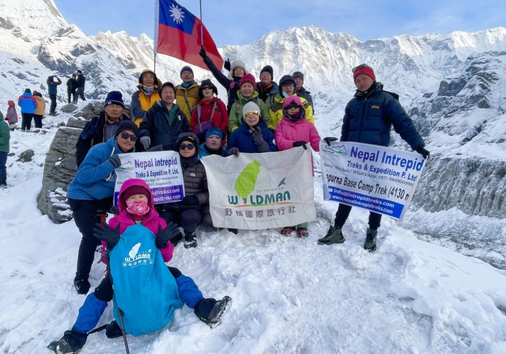
Annapurna Base Camp Trek:
The Annapurna Base Camp (ABC) trek offers dramatic mountain views in a shorter timeframe than longer routes like the Annapurna Circuit. Base camp lies at 4,130 meters, set in a high basin surrounded by towering peaks on all sides. These include Annapurna I, Annapurna South, Hiunchuli, Gangapurna, and Machhapuchhre the sacred “Fishtail” mountain, which remains unclimbed.
Route, Duration, and Difficulty
The standard Annapurna Base Camp (ABC) trek takes 7–10 days round-trip from Pokhara. After a short drive to the trailhead, the trail ascends through terraced farmland and rhododendron forests to Chhomrong. From there, it follows the Modi Khola gorge past bamboo forests and alpine scrub before reaching the rocky basin of base camp at 4,130 meters.
The trek is moderately difficult. Although it doesn’t reach the altitudes of Everest Base Camp or Thorong La, it involves steep ascents and descents, especially on the stone staircases between Chhomrong and Machhapuchhre Base Camp. These sections can be hard on knees during the descent. The narrow gorge can also experience sudden weather changes, and during certain seasons, avalanche risk may lead to temporary trail closures.
Views Inside the Annapurna Sanctuary
Sunrise at Annapurna Base Camp offers close-up views of surrounding peaks, with mountains rising steeply on all sides. On clear nights, the high altitude and lack of light pollution create excellent stargazing conditions.
The teahouse network along the route is well-established and friendly, making this trek suitable for beginners with a moderate level of fitness. In spring, rhododendrons bloom in the lower forests, while autumn offers the clearest skies and most reliable mountain views.
Gokyo Lakes and Gokyo Ri Trek:
The Gokyo Valley trekking route offers a quieter alternative to the main Everest Base Camp trek. From Namche Bazaar, the trail turns west and follows the Ngozumpa Glacier, the longest in Nepal toward a series of glacial lakes known for their striking turquoise color.
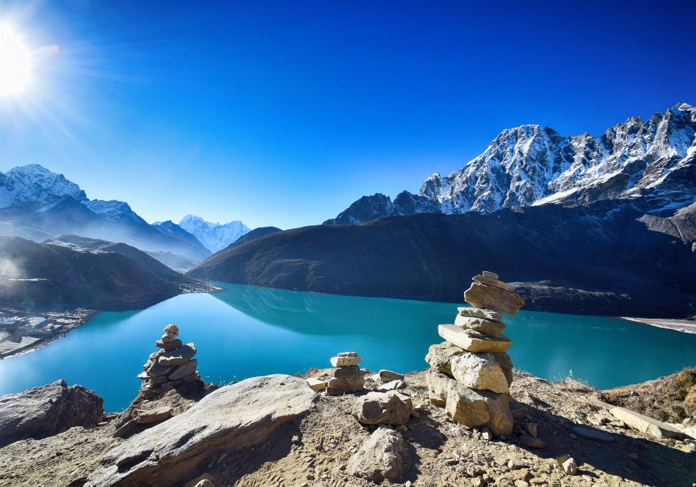
High-Altitude Lakes and Viewpoints
The Gokyo Lakes are a group of six glacial lakes, with the main three being the most visited. Their bright turquoise color contrasts sharply with the surrounding gray rock and white ice. Gokyo village, at 4,790 meters beside the third lake, serves as a base for rest and exploration.
From the village, a climb to Gokyo Ri (5,357 meters) offers one of Nepal’s best viewpoints. From the summit, you can see Everest, Lhotse, Makalu, and Cho Oyu; four of the world’s six highest peaks as well as the vast Ngozumpa Glacier below.
The full trek from Lukla to Gokyo and back takes 10–15 days. It is less crowded than the Everest Base Camp route, and the teahouses are more basic. However, the altitude challenges are similar. You'll sleep above 4,500 meters for several nights so proper acclimatization is essential.
Linking Gokyo With EBC via Cho La Pass
Many experienced trekkers link the Gokyo Lakes and Everest Base Camp routes by crossing Cho La Pass (5,420 meters), which connects the two valleys. The pass involves steep sections, boulder scrambling, and potential ice crossings, so hiring a guide is common even for those trekking independently.
This combined route typically takes 16–19 days and includes both highlights: Gokyo’s glacier lakes and panoramic views, along with Everest Base Camp and Kala Patthar. It’s best suited for fit, experienced trekkers who want a longer itinerary and full coverage of the Khumbu region.
Manaslu Circuit Trek:
The Manaslu Circuit trek offers a complete circuit around Mount Manaslu, the world’s eighth-highest peak. The route includes a high pass crossing, varied landscapes from lowland farms to alpine terrain and a mix of Hindu and Tibetan Buddhist villages. It’s a less crowded alternative to the Annapurna Circuit, with a strong sense of remoteness and gradual change each day.
Permits, Guides, and Regulations
Because the Manaslu region is a restricted area, independent trekking is not allowed. You must hire a registered guide through a licensed agency and obtain three permits: the Manaslu Restricted Area Permit, the Manaslu Conservation Area Permit, and the TIMS card. Permit costs are higher than in unrestricted regions, but generally lower than those for Upper Mustang or Dolpo. These rules help control visitor numbers and ensure tourism revenue supports local communities.
A group must include at least two trekkers, but solo travelers can usually join others through an agency. In this region, having a guide is especially useful as the trails are less clearly marked than in busier areas, and a guide can help bridge language and cultural gaps in more isolated villages.
Larke Pass and Trek Difficulty
The Manaslu Circuit typically takes 14–18 days, depending on rest days and route variations. The trail follows the Budhi Gandaki River through a range of environments from Hindu farming villages in the lowlands to Tibetan Buddhist settlements in the upper valley. Samagaun and Samdo are common acclimatization stops before the ascent to Larke Pass at 5,106 meters.
Crossing Larke Pass is one of the trek’s most challenging days. Trekkers start early and climb for 5–7 hours over exposed terrain, followed by a steep descent. While Thorong La sees hundreds of trekkers per day in peak season, Larke Pass is much quieter, often with just a few dozen. The views from the pass stretch back toward Manaslu and forward to the Annapurna range, offering a strong sense of accomplishment.
Teahouse accommodation is available throughout the circuit, but it is more basic than in the Everest or Annapurna regions, with limited food options and colder rooms at higher elevations.
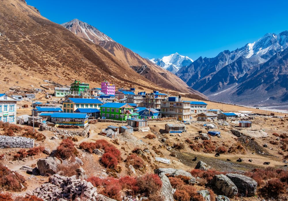
Langtang Valley Trek:
The Langtang Valley trek is a short but rewarding introduction to the Himalayas. Starting from Syabrubesi, the trail heads north toward the Tibetan border, passing through subtropical forests, alpine meadows, and glacial terrain. Though the surrounding peaks rise above 7,000 meters, the trail itself stays below 4,000 meters, making altitude acclimatization easier than on high-pass treks.
Scenery and Side Trips From Kyanjin Gompa
The trail follows the Langtang Khola River through forests where red pandas live, although sightings are rare. Several lower villages, including Langtang village, were destroyed by landslides during the 2015 earthquake. The community has since rebuilt higher along the valley slopes, and trekking here now directly supports local recovery efforts.
Kyanjin Gompa, at 3,870 meters, is the main trekking hub in the upper valley. From this small village home to a monastery and a traditional cheese factory, you can take day hikes to Kyanjin Ri (4,773 meters), Tserko Ri (4,984 meters), or toward Langtang Lirung base camp. These side trips offer strong acclimatization benefits and excellent views without requiring higher overnight stays.
The full trek, including side hikes, usually takes 7–10 days. Because the valley is relatively compact, it can also be extended to Gosaikunda’s sacred lakes or across the Ganja La Pass into the Helambu region. This route is ideal for first-time Himalayan trekkers, those on limited schedules, or experienced hikers seeking a quieter alternative to Everest or Annapurna.
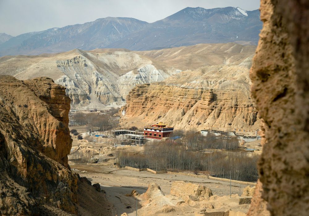
Upper Mustang Trek:
Upper Mustang is a high-altitude desert in northern Nepal with strong Tibetan cultural roots. Unlike Tibet, Buddhism here was never suppressed, and religious traditions remain active. The former Kingdom of Lo held semi-autonomous status until 1950 and was closed to foreign visitors until 1992. Access today still requires special permits and high fees, which help limit tourism and protect the region’s distinct culture and landscape.
Culture, Monasteries, and Lo Manthang
The trek to Lo Manthang begins from Kagbeni in the Kali Gandaki valley, following ancient trade routes north through dry, canyon-like landscapes in shades of red, gray, and ochre. Villages such as Chele, Samar, and Ghami are built around whitewashed monasteries, with large chortens marking key points along the trail. The region is arid, receiving only a few centimeters of rain per year, and the landscape is largely treeless.
Lo Manthang, the former capital of the Kingdom of Lo, is a walled city that has served as the region’s cultural center for over 600 years. Inside the walls are flat-roofed buildings, including the Raja’s palace and several historic monasteries with ancient murals and statues. While modern elements like solar panels and satellite dishes have appeared, traditional ways of life remain. Nearby, trekkers can explore cliffside caves, some with carvings and paintings, others believed to have been used for sky burials, adding further insight into Mustang’s history and culture.
Permits, Costs, and When to Go
Trekking in Upper Mustang requires a Restricted Area Permit costing about $500 USD for the first 10 days, and $50 per additional day. Trekkers must go with a registered guide and obtain permits through a licensed agency. Because of the permit fees and the need for full logistical support, total costs are significantly higher than in unrestricted trekking regions.
The standard Upper Mustang trek takes 10–14 days, depending on route choices and side trips. Most trekkers visit in spring (March–May) or autumn (September–November) for stable weather. However, Mustang is also one of the few regions in Nepal suitable for monsoon-season trekking (June–August), thanks to its location in the Himalayan rain shadow.
The route stays below 4,000 meters and does not involve high passes, making it moderate in difficulty. The focus is cultural rather than alpine, ideal for trekkers interested in Tibetan Buddhism, traditional architecture, and Mustang’s desert landscapes rather than high-altitude summits.
When to Trek in Nepal: Best Seasons and Weather
Timing your trek is just as important as choosing the route. Nepal’s trekking seasons vary widely in terms of temperature, rainfall, visibility, and trail conditions. There is no single “best” season; it depends on the region you’re visiting, your comfort with cold or crowds, and the kind of experience you want.
Trekking in Nepal in Spring (March–May)
Spring is one of Nepal’s main trekking seasons. As winter fades, temperatures rise, making high-altitude routes more comfortable. March can still be cold at elevation, but April and May offer warmer days above 4,000 meters, though nights remain chilly.
A highlight of spring trekking is the rhododendron bloom. From late March through April, forests especially in the Annapurna and Langtang regions fill with red, pink, and white blossoms. These colorful trees contrast beautifully with the snow-covered peaks.
Visibility is generally good, though not as clear as in autumn. Mornings often bring excellent views, but clouds tend to build by afternoon, especially in May. Pre-monsoon haze and occasional showers may appear at lower elevations toward the end of the season.
Spring becomes progressively busier, especially on popular trails like Everest Base Camp and the Annapurna Circuit. Crowds grow in April and May, but still tend to be smaller than during autumn’s peak.
Trekking in Nepal in Autumn (September–November)
Autumn is Nepal’s most popular trekking season. The monsoon rains clear dust and haze from the air, leaving behind excellent visibility. October and November offer the clearest mountain views of the year. Temperatures are mild at lower elevations, while higher areas grow colder as winter approaches.
September is a transitional month. Early in the month, some afternoon storms and leeches may linger, especially in eastern or lower regions. By mid-September, weather patterns stabilize. October brings ideal conditions—clear skies, stable temperatures, and reliable trails across all elevations. November is colder, particularly at night, and high passes may receive snow, but days remain mostly dry and clear.
The main drawback of autumn is the crowds. In October and early November, popular routes like Everest Base Camp and the Annapurna Circuit can be busy. Teahouses fill quickly, helicopter activity increases in high-traffic areas like the Khumbu, and viewpoints may be crowded.
For fewer people, consider trekking in mid-September or late November, or choose lesser-known routes with fewer visitors.
Trekking in Nepal in Winter (December–February)
Winter is a quiet trekking season in Nepal, often overlooked due to the cold. Daytime temperatures are comfortable at lower elevations, but above 3,500 meters, nights are freezing, and mornings remain cold even under clear skies.
The main advantages are crystal clear visibility and minimal crowds. Trails are often empty, and the clean, dry air provides excellent mountain views. Lower elevation routes such as Poon Hill, Langtang Valley, and the lower sections of longer treks are ideal in winter. High passes like Thorong La and Larke Pass may close due to snow. Everest Base Camp remains accessible but requires proper cold-weather gear.
Accommodation can be limited. Many high-altitude teahouses close for the season, and some villages are temporarily abandoned as residents move to warmer areas. Winter trekking requires careful planning and warm equipment, including a sleeping bag rated for -10°C to -15°C.
This season is best for experienced trekkers who are prepared for cold conditions and want quiet trails and dramatic scenery.
Trekking in Nepal During the Monsoon (June–August)
The monsoon season (June to August) is typically considered off-season for trekking due to heavy rain, especially in Nepal’s southern and eastern regions. Afternoon and evening downpours make trails muddy and slippery. Landslides may block roads or paths, and leeches are common at lower elevations. Mountain views are often obscured by clouds for days.
However, rain-shadow regions such as Upper Mustang, Dolpo, and parts of northern Manaslu receive far less rainfall and remain good options during the monsoon. Upper Mustang, in particular, offers dry, stable conditions and is a recommended destination in this season.
Trekking in non-rain-shadow areas during monsoon requires accepting several challenges: poor visibility, wet gear, trail damage, and frequent leeches. However, these conditions also bring lush green landscapes, blooming wildflowers, full rivers, and nearly empty trails. Rice paddies are at their most vibrant, and waterfalls are especially dramatic.
This season is best for adventurous trekkers who prioritize solitude and greenery over clear skies and dry paths.
Trekking Permits and Regulations in Nepal
Nepal uses a permit system to manage access to protected areas, support local communities, and control visitor numbers in sensitive regions. Knowing which permits are required, where to get them, and how much they cost helps avoid delays and confusion when planning your trek.
Standard Permits for Popular Trekking Regions
Most trekking areas in Nepal require two main types of permits:
-
TIMS Card (Trekkers’ Information Management System)
-
Tracks trekker movement for safety and recordkeeping.
-
Costs approximately $20 USD for independent trekkers or $10 USD if obtained through a registered agency.
-
Required for most standard trekking regions.
-
Conservation Area or National Park Permits
-
Fund conservation and support local communities.
-
Issued based on the trekking region:
-
Sagarmatha National Park Permit – for Everest region treks ($30 USD)
-
Annapurna Conservation Area Permit (ACAP) – for all Annapurna region treks ($30 USD)
-
Langtang National Park Permit – for Langtang Valley treks ($30 USD)
These permits are easy to obtain through licensed trekking agencies or at Nepal Tourism Board offices in Kathmandu and Pokhara. Most agencies handle permit processing as part of their service.
Restricted Areas and Special Permits
Certain trekking regions in Nepal are classified as restricted areas due to their cultural sensitivity and remote location. These areas require special permits, higher fees, and a mandatory registered guide. Permits must be obtained through licensed agencies.
Key Restricted Area Permits:
-
Manaslu Restricted Area Permit
-
Required for Manaslu Circuit treks
-
Costs:
-
$70 USD for the first 7 days (Sept–Nov)
-
$50 USD for the first 7 days (other months)
-
$10 USD per additional day
-
A registered guide is required
-
Upper Mustang Restricted Area Permit
-
Costs $500 USD for the first 10 days
-
$50 USD per day beyond 10 days
-
Only available through registered agencies
-
Guide is mandatory
-
Dolpo Restricted Area Permit
-
Fees vary by region, typically $500+ USD for 10 days
-
Requires agency-based trekking and a registered guide
Restricted area permits are more expensive than standard permits, but they help manage tourism impact and ensure that revenue supports isolated communities with limited economic alternatives.
Where and How to Get Your Permits
1. Nepal Tourism Board Offices
-
The main office in Kathmandu (Bhrikutimandap) issues TIMS cards and most national park and conservation permits.
-
A second office in Pokhara handles permits for Annapurna region treks.
-
Bring:
-
Passport photocopies
-
2–4 passport-sized photos
-
Cash payment (USD or NPR)
2. Through Trekking Agencies
-
Most agencies arrange all necessary permits for their clients, including those for restricted areas, which cannot be obtained independently.
-
This option saves time and ensures correct paperwork, especially for complex treks.
3. At Trail Entry Points
-
Some permit types (like national park entry fees) can be paid at checkpoints along the trail.
-
However, it’s generally easier to get all permits in Kathmandu or Pokhara before departing.
Tips for Independent Trekkers
-
Setting aside at least half a day in Kathmandu for permit processing offices can be slow, especially during peak season.
-
Bring multiple passport photos, as different permits may require separate copies.
Permit Costs and Validity (Approximate)
Permit fees vary over time, so treat these amounts as general estimates:
-
TIMS Card:
-
$10 USD (through an agency)
-
$20 USD (independent trekkers)
-
National Park / Conservation Permits (each):
-
Sagarmatha National Park (Everest region): ~$30 USD
-
ACAP – Annapurna Conservation Area: ~$30 USD
-
Langtang National Park: ~$30 USD
-
Restricted Area Permits:
-
Manaslu: $70–100 USD for the first 7 days, depending on season, plus $10/day after
-
Upper Mustang: $500 USD for 10 days, plus $50/day after
-
Dolpo: Starting at $500 USD for 10 days (varies by region)
Most permits are valid for the duration of your trek, with a small buffer included. Extensions are sometimes possible, but the process is slow and can be complicated. It's best to apply with extra days built into your plan.
Acclimatization, Altitude, and Trekking Safety
Altitude is the most important factor affecting success on high-elevation treks. Unlike physical fitness, your body’s response to altitude varies individually and can’t be predicted or trained for. However, following established acclimatization practices such as ascending gradually, taking rest days, and staying hydrated greatly reduces the risk of altitude illness and improves your chances of completing the trek safely.
How Altitude Affects Your Body
As elevation increases, atmospheric pressure drops and oxygen levels decrease. At 3,500 meters, the body receives about 35% less oxygen than at sea level. At 5,500 meters, the reduction is closer to 50%. To adapt, your body increases breathing rate and gradually produces more red blood cells.
Altitude effects often begin around 2,500–3,000 meters, with mild symptoms like headaches, reduced appetite, and shortness of breath during exertion. These are normal and usually manageable.
Problems arise when you ascend too quickly, which can lead to Acute Mountain Sickness (AMS). More serious forms HACE (High Altitude Cerebral Edema) and HAPE (High Altitude Pulmonary Edema) are rare but life-threatening and require immediate descent.
Key point: Your body needs time to adjust. Physical fitness does not prevent altitude illness, though it can make trekking at high elevations feel less strenuous.
Acclimatization Best Practices
To reduce the risk of altitude illness, follow these established guidelines:

-
Climb high, sleep low
Hike to a higher elevation during the day, then return to sleep at a lower altitude. This helps your body adapt more effectively. -
Limit daily altitude gain
Above 3,000 meters, avoid increasing your sleeping altitude by more than 300–500 meters per day. Include a rest day for every 3–4 days of ascent. -
Use acclimatization days actively
Side hikes to higher elevations improve adaptation more than staying idle. Return to sleep at your original altitude after the hike. -
Pay attention to symptoms
If you develop signs of altitude sickness, stop ascending. If symptoms worsen, descend immediately. Delayed response increases risk of serious illness. -
Stay hydrated
Drink 3–4 liters of water daily. Dehydration can intensify altitude symptoms. -
Eat consistently
Appetite often decreases at altitude, but consistent eating especially carbohydrate-rich meals helps energy levels and adaptation. -
Consider medication
Acetazolamide (Diamox) may help prevent altitude sickness. Consult a doctor experienced in altitude medicine before using it.
Recognizing Altitude Sickness Symptoms
Understanding the signs of altitude illness is essential for staying safe on high-elevation treks.
Mild AMS (Acute Mountain Sickness):
Symptoms may include:
-
Headache
-
Fatigue
-
Dizziness
-
Trouble sleeping
-
Mild nausea
-
Loss of appetite
These are common above 2,500–3,000 meters. You can remain at your current altitude but should not ascend further until symptoms improve.
Moderate to Severe AMS:
Symptoms may include:
-
Headache unresponsive to medication
-
Persistent vomiting
-
Increasing fatigue or weakness
-
Mental confusion
-
Difficulty with coordination
These symptoms require immediate rest and no further ascent. If they don’t improve, descend as soon as possible.
Severe Altitude Illnesses (Medical Emergencies):
-
HACE (High Altitude Cerebral Edema):
-
Severe confusion
-
Hallucinations
-
Loss of coordination or balance
-
Unconsciousness
-
HAPE (High Altitude Pulmonary Edema):
-
Shortness of breath at rest
-
Coughing up pink, frothy fluid
-
Blue lips or fingertips
-
Chest tightness
If any of these occur, descend immediately by 500–1,000 meters and seek medical help.
Monitoring Symptoms:
Guides often use the Lake Louise AMS Scoring System to track symptoms daily. Be honest about how you feel early reporting allows for quicker response and safer outcomes.
General Safety Tips on the Trail
Nepal’s trekking trails are generally safe, but there are a few key risks to manage beyond altitude:
-
Pack animals (yaks and mules):
Always stand on the mountain side of the trail (away from the edge) when animals pass. They can be wide and unpredictable. -
Trail conditions:
Be cautious on loose stones, snow, mud, or ice. Trekking poles improve balance and reduce knee strain. -
Weather changes:
Mountain weather can shift quickly. Always carry rain gear and warm layers, even if the day starts clear. -
River crossings:
Some routes involve suspension bridges or shallow streams. Ask locals or guides for the safest crossing times and methods. -
Health and hygiene:
Use hand sanitizer or soap regularly, especially before eating. Stomach issues are common; bring basic medications and always treat drinking water (use filters, tablets, or boil it). -
Communication and check-ins:
Mobile coverage exists in many areas but isn’t guaranteed. Share your itinerary with someone, and check in at police checkpoints and lodges to create a record of your progress especially if trekking independently.
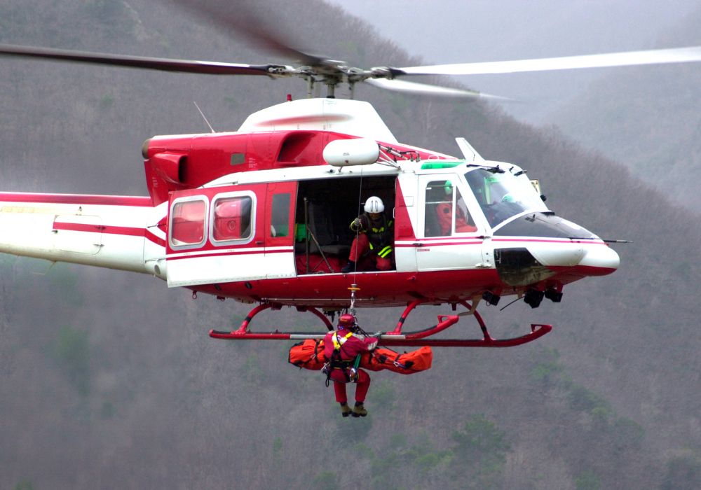
Helicopter Rescue and Travel Insurance
Helicopter rescue is available in most trekking regions and is the standard response for severe altitude illness or serious injury. However, evacuations are expensive, typically $5,000 to $10,000 USD, depending on location.
Standard travel insurance often excludes high-altitude trekking. You’ll need a policy that specifically covers:
-
Trekking to your planned maximum altitude
-
Helicopter evacuation
-
Pre-existing conditions, if applicable
-
Direct payment to service providers (some policies reimburse only after you pay upfront)
Specialized insurers such as World Nomads, Global Rescue, or companies focused on high-altitude coverage often meet these requirements.
Before your trek, review your policy carefully and clarify:
-
What altitude is covered?
-
Is helicopter rescue included?
-
How are emergency payments handled?
-
Are there any exclusions based on health history?
Keep your insurance contact information saved both on your phone and on paper. In an emergency, lodge staff or rescue teams need this info quickly. Proper coverage can prevent delays and avoids the risk of paying thousands out of pocket.
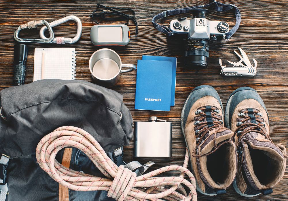
Essential Trekking Gear Checklist for Nepal
Having the right gear is essential for staying warm, dry, and comfortable on Himalayan treks. You don’t need top-brand equipment, but every item should function well in cold and possibly wet conditions.