Nepal is an excellent destination for adventure, spiritual renewal, and cultural connections. Furthermore, Nepal has been a popular trekking destination in recent years. As a result, Nepal draws around 2,000,000 hikers each year. That also means that every year, over 2,000,000 individuals must make the difficult decision of which trekking place to visit in Nepal. So, in this article, we are going to talk about the top 10 trekking destinations in Nepal.
Top 10 Trekking Destinations in Nepal
The top 10 trekking destinations in Nepal is not an easy choice to make. Naturally and culturally diverse countries like Nepal offer a lot of choices when it comes to adventure and lifetime memorable journeys.
While selecting the top 10 trekking destinations in Nepal, natural and cultural diversity along with the trekking route’s popularity are considered.
Here are the top 10 trekking destinations in Nepal
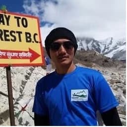
Everest Base Camp Trek
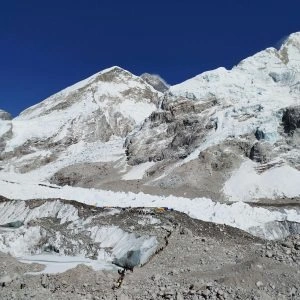
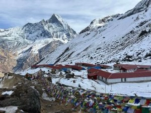
When talking about the top 10 trekking destinations in Nepal, Everest Base Camp is a no-brainer. Additionally, Everest Base Camp Trek is the most popular destination among the trekkers. Being at the base camp on the top of the world must be one of the most thrilling feelings ever. Furthermore, this trek provides a once-in-a-lifetime opportunity to see a close-up look at Mount Everest, the world’s tallest mountain.
Aside from reaching the foot of the magnificent Mt Everest, you will be able to enjoy breathtaking views of the Solukhumbu area. In addition, This walk also takes you via Namche Bazar, a commercial town between Tibet and the Sherpas. Then, across the valley, follow the Dudh Kosi River. Lastly, the final road travels through a beautiful woodland among settlements, and the trek concludes at Luka.
Difficulty level: Moderate to Difficult
Best time to visit: March to May and September to November
Annapurna Base Camp Trek
Annapurna Base Camp Trek is among the top 10 trekking destinations in Nepal choices of any trekking enthusiasts. Additionally, this trek is a must-in-a-lifetime trekking route to be visited. Moreover, the Annapurna Base Camp Trek is a trekking adventure package that brings you near to Nepal’s Annapurna massif, showcasing the mountains’ beautiful, enormous, and majestic aspects. This journey takes you to the base camp of Mt. Annapurna, the world’s tenth-tallest peak.
In addition, The ABC journey is full of amazing hikes through unique landscapes, gorges with spectacular mountain vistas you may have never seen before, and faunas of various species intertwined with terraced rice fields and local Gurung communities.
Difficulty level: Moderate
Best time to visit: March to May and September to November
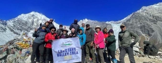
Langtang Valley Trek
The Langtang Valley Trek is very famous. Additionally, this trek is not very far from Kathmandu Valley. Langtang is an excellent trek that provides cultural insights such as monasteries and local communities.
Furthermore, this walk takes you to glaciers and snow-capped mountains not far from Kathmandu. You continue your journey through pine forests, gravel streams, rocks, green meadows, and vast pastures. Mt. Langtang-Ri, Langtang Himal, and Ganjala Peak are all visible from here.
Difficulty level: Moderate
Best time to visit: March to May and September to November
Ghorepani Poonhill Trek
Ghorepani Poonhill Trek is Nepal’s great classic and very popular route among beginners because of its fairly easy trails in comparison to other hardcore trails.
The trekking route expands between Pokhara and Nayapul, admiring the spectacular mix of high peaks, the Poon Hill summit, and beautiful villages. Furthermore, this hike will take you through the magnificent scenery of Fishtail Mountain, Annapurna, and Dhaulagiri, as well as rhododendron woods and mountain towns. This tour is ideal for adventure seekers looking to immerse themselves in a new culture and breathtaking natural environment.
Difficulty level: Easy to Moderate
Best time to visit: March to May and September to November
Upper Mustang Trek
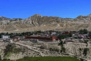
Mustang is a very popular destination among trekkers from abroad as well as from Nepal. Additionally, the Mustang, a former Himalayan Kingdom, is regarded as the final refuge of Tibetan culture. Furthermore, this is a fantastic alternative for those seeking distinct Tibetan culture as well as breathtaking scenery. Moreover, the ancient kingdom of Mustang, which was closed to tourists until 1992, is without a doubt Nepal’s most mystical territory.
This high-altitude desert, hidden behind the mountains of Nepal’s Himalayas, provides an incredible playground for trekkers seeking remarkable scenery and authentic interactions. As we stroll through steep valleys, mountain passes, and plateaus, discovering the region’s remarkable natural sites: fairy chimneys, cliffs, and gorges without bottoms, all dominated by a great vista of the massive Annapurna and Dhaulagiri ranges.
Difficulty level: Moderate to Difficult
Best time to visit: March to May and September to November
Rara Lake Trek
The Rara Lake Trek brings you to the isolated villages of Nepal’s Jumla and Mugu districts. The lake, often known as the “Queen of Lakes,” offers incredible sensations and tranquillity.
This hike takes you across the rugged terrains of the Trans-Himalayan Alps. You pass through the old settlement of Mincha, which is known for its Buddhist stupas. This hike begins at Jumla, which is reached via a flight from Nepalgunj.
Difficulty level: Moderate to Difficult
Best time to visit: March to May and September to November
Manaslu Circuit Trek
The Manaslu walk, a cultural trek par excellence and without a doubt one of the top treks in Nepal, first opened for trekking in the early 1990s. The hike revolves around Mount Manaslu, Nepal’s eighth-highest mountain. This trip takes you through spectacular scenery while passing several suspension bridges.
The ‘Larkya La Pass,’ one of the most stunning routes traversing the Himalayas, is the major highlight and highest point of the Manaslu Circuit trip. The summit of Larkya La offers breathtaking views of Manaslu, Cheo Himal, Himal Chuli, and Himlung Himal. The journey also provides an opportunity to experience the region’s rich local cultural and ecological variety.
Difficulty level: Moderate to Difficult
Best time to visit: March to May and September to November
Tsum Valley Trek
Tsum Valley in Nepal is a magnificent hidden secret of Tibetan Buddhists on the outskirts of one of the most remote Himalayan valleys. The region was closed to visitors until 2008, so it hasn’t been long since it reopened. The location is still less visited and exploited than other tourist spots, with less used roads than more popular areas.
The Tsum Valley journey takes you through the breathtaking scenery of the Ganesh, Sringi, and Boudha Himal peaks. The region was previously part of Tibet and still appears very different from the rest of the country. We journey through alpine woods and glacial rivers, enjoy the warm hospitality of ethnic people, and see the region’s old Gumpas, such as Rachen Gumpa and Mu Dephyudonma Gumpa.
Difficulty level: Moderate
Best time to visit: March to May and September to November
Kanchenjunga Base Camp Trek
One of the greatest treks in rural eastern Nepal is the Kanchenjunga Base Camp Trek. If you are up for a challenge and want to enjoy a hike in solitude, this is the route for you.
This journey takes you through the culture and natural splendour of eastern Nepal. The voyage occurs in the harsh high-mountain environment of Nepal’s border with Sikkim and Tibet, deep into the remote Himalayan ranges. The walk exposes you to untouched local culture and beautiful scenery, making it a worthwhile adventure. The journey takes you through tropical lowlands and thick Rhododendron woods. The route passes past Tibetan tribes’ settlements, such as Rai and Limbus.
Difficulty level: Difficult
Best time to visit: March to May and September to November
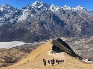
Gokyo Lake Trek
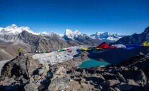
The Gokyo trip, located just west of the Everest Base Camp climb, is an excellent option for those seeking fewer visitors and more secluded surroundings.
Gokyo Valley is a valley of glaciers and icy lakes. The walk winds through rhododendron and oak woodlands with rich flora and wildlife. The waterfalls that are mostly frozen are fascinating. The valley protects a variety of high-altitude wetlands and freshwater lake systems. The town is a haven for lone Tibetan Buddhist Sherpas, complete with antique monasteries and traditions.
Difficulty level: Moderate
Best time to visit: March to May and September to November
Hence, the top 10 trekking destinations in Nepal are the most popular and most rewarding treks throughout the world. So choose your trek among these top 10 trekking destinations in Nepal.