Nepal’s UNESCO World Heritage Sites form one of the most concentrated cultural and natural heritage landscapes in the world, preserving a continuous record of over 2,500 years of history, religion, architecture, and ecology. Spread across four UNESCO properties and ten major heritage zones, these sites include the historic monument complexes of the Kathmandu Valley, the sacred birthplace of Buddha at Lumbini, the biodiversity-rich lowland ecosystems of Chitwan National Park, and the Himalayan mountain system anchored by Sagarmatha National Park and Mount Everest.
Together, these heritage sites illustrate Nepal’s unique position at the intersection of ancient South Asian civilizations, living Hindu and Buddhist traditions, and some of the planet’s most extreme natural environments. From intricately carved Newari pagoda temples and royal palace squares to hemispheric Buddhist stupas, sacred pilgrimage centers, and high-altitude glacial landscapes, each site reflects a distinct dimension of cultural continuity, spiritual significance, and ecological diversity that defines Nepal’s global heritage identity.
1. Bhaktapur Durbar Square: World Heritage Sites
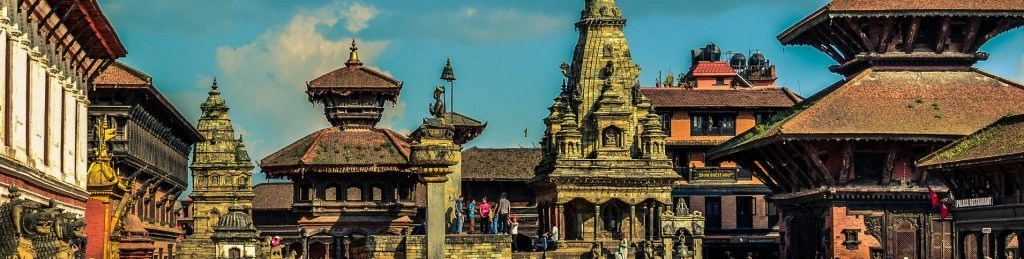
Bhaktapur Durbar Square is a medieval royal palace complex located 13 km east of Kathmandu at 1,401 meters elevation in Bhaktapur city, inscribed by UNESCO in 1979 as part of the Kathmandu Valley World Heritage Site for its exceptional concentration of 15th–18th century Newari pagoda architecture, royal courtyards, and Hindu iconography.
Bhaktapur derives from the Sanskrit Bhadgaon, meaning "City of Devotees." The city was established in the 9th century CE and served as the capital of the Malla Kingdom from the 12th to 15th centuries. The Durbar Square functions as the ceremonial and administrative center of that kingdom.
What Are the 4 Main Architectural Monuments Inside Bhaktapur Durbar Square?
The square contains 4 principal monuments: the 55-Window Palace, Nyatapola Temple, Vatsala Temple, and the Golden Gate (Sun Dhoka).
55-Window Palace (Pachpanna Jhyale Durbar): Built in 1427 CE under King Yaksha Malla, expanded by King Bhupatindra Malla. The palace contains 55 intricately carved peacock windows in a continuous terracotta-and-wood facade, the largest concentration of carved windows in a single Nepali structure.
Nyatapola Temple: A 5-story pagoda built in 1702 CE under King Bhupatindra Malla. Standing 30 meters tall, Nyatapola is the tallest pagoda temple in Nepal. The temple is dedicated to Siddhi Lakshmi and guarded by 5 pairs of monumental stone guardians at each ascending terrace.
Vatsala Durga Temple: A 17th-century shikhara-style stone temple dedicated to Vatsala Devi. The temple incorporates a large bronze bell, the "Bell of Barking Dogs", cast in 1737 CE.
Golden Gate (Sun Dhoka): Cast in gilded copper and repousse art in 1753 CE, the gate depicts a 4-faced, 10-armed image of Taleju Bhawani. It is the most artistically complex metal gateway in Nepal.
What Is the Significance of Newari Architecture at Bhaktapur Durbar Square?
Newari architecture refers to the traditional building style of the Newar people of the Kathmandu Valley, characterized by 3 structural elements: fired-brick walls, multi-tiered sloping roofs with gilded copper finials, and carved wood lattice windows depicting deities, erotic motifs, and mythological scenes.
Bhaktapur Durbar Square contains 172 individual structures documented by the Department of Archaeology, Nepal. The 2015 Gorkha earthquake (7.8 magnitude) damaged 47 structures within the square. Restoration work conducted between 2016 and 2023 reconstructed 31 damaged monuments using original materials sourced from traditional Bhaktapur brick kilns.
Visitors pay a separate entry fee of NPR 1,800 (approximately USD 13) for Bhaktapur Durbar Square, the highest entry fee among the 7 Kathmandu Valley sites.
2. Kathmandu Durbar Square
Kathmandu Durbar Square, also called Hanuman Dhoka Durbar Square, is the historic royal palace plaza of old Kathmandu city, inscribed by UNESCO in 1979 for its 50+ temples, shrines, and palace buildings representing 12th–18th century Malla and early Shah dynasty architecture. The square served as the coronation site for Nepal's Shah kings from 1768 to 2001.
Kathmandu Durbar Square occupies the geographic heart of Kathmandu, situated in Ward 23 of Kathmandu Metropolitan City at 1,310 meters elevation. The Hanuman Dhoka Palace, the central structure, takes its name from the large statue of Hanuman (the Hindu monkey deity) placed at the main gate in 1672 CE by King Pratap Malla.
What Are the 3 Most Historically Significant Structures in Kathmandu Durbar Square?
The 3 most historically significant structures are Kasthamandap, the Kumari Ghar, and Taleju Temple.
Kasthamandap: A 3-story wooden pavilion originally built in the 12th century CE, constructed from the timber of a single sal tree (Shorea robusta) according to traditional records. The structure gave Kathmandu city its name, Kasthamandap translates as "wooden shelter." The 2015 earthquake completely collapsed the building; reconstruction was completed in 2022 using reclaimed original wood.
Kumari Ghar (Living Goddess House): A 3-story 18th-century courtyard palace built in 1757 CE. The Kumari Ghar is the residence of the Royal Kumari, the Kumari living goddess of Kathmandu, selected from pre-pubescent girls of the Shakya goldsmith caste through a 32-point selection process. The courtyard contains 32 elaborately carved wooden windows depicting deities and tantric iconography.
Taleju Temple: A 12-story pagoda built in 1564 CE by King Mahendra Malla, rising 36.6 meters above the square. The temple is dedicated to Taleju Bhawani, the royal tutelary goddess of the Malla dynasty. It opens to the general public only once per year during the Indra Jatra festival in September.
What Damage Did the 2015 Earthquake Cause at Kathmandu Durbar Square?
The April 2015 Gorkha earthquake (7.8 Mw) and the May 2015 aftershock (7.3 Mw) destroyed or severely damaged 19 structures at Kathmandu Durbar Square, including the complete collapse of Kasthamandap and Maju Deval temple. UNESCO, together with the Government of Nepal, has overseen the reconstruction of 170 heritage structures across the Kathmandu Valley World Heritage Property since the 2015 earthquake, with only 11% of all damaged monuments still under restoration as of December 2025, according to UNESCO's Kathmandu Valley recovery report.
3. Boudhanath Stupa
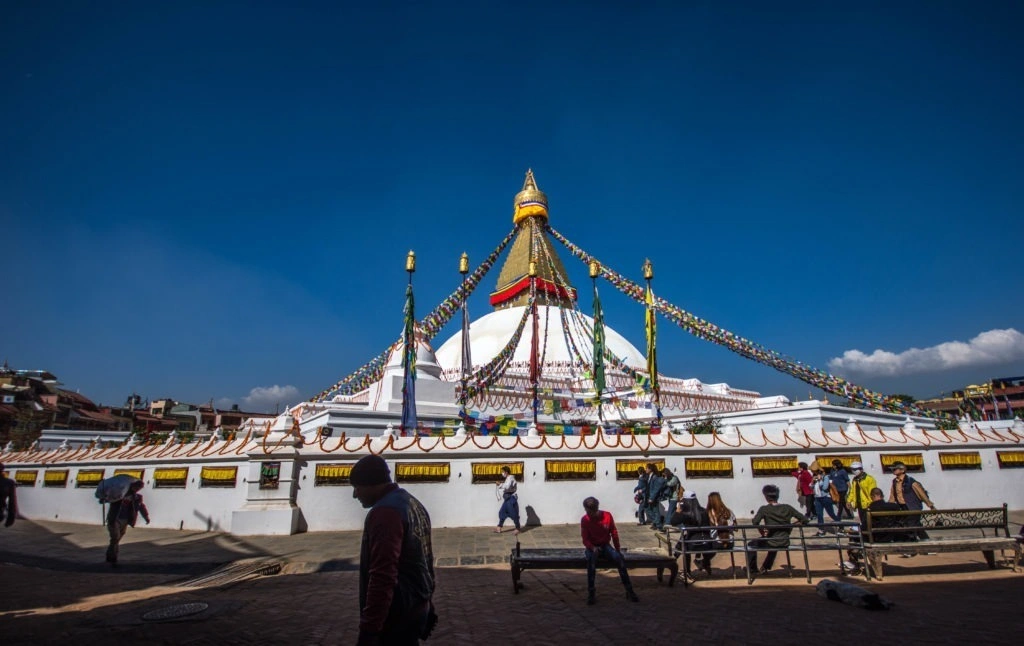
Boudhanath Stupa is one of the largest hemispheric Buddhist stupas in the world, located 11 km northeast of Kathmandu city center at 1,324 meters elevation, inscribed by UNESCO in 1979. The stupa measures 36 meters in height with a base circumference of 100 meters and serves as the principal center of Tibetan Buddhism in Nepal.
Stupa, from Sanskrit stūpa, meaning "heap", is a dome-shaped Buddhist monument housing sacred relics. Boudhanath Stupa specifically houses the remains of Kassapa Buddha (the predecessor of Gautama Buddha) according to Buddhist scriptures.
What Is the Origin and History of Boudhanath Stupa?
Boudhanath Stupa was constructed between the 5th and 6th centuries CE during the Licchavi dynasty of Nepal. Historical records in the Gopālarājavaṃśāvalī chronicle date the original construction to the reign of King Mānadeva I (c. 464–505 CE). The stupa was enlarged during the 8th century CE and restored in the 14th century after Mughal forces damaged its upper sections.
The 4 pairs of Buddha eyes painted on all 4 cardinal faces of the stupa's harmika (square tower) represent the omniscience of Buddha, seeing in all 4 directions. The 13 rings of the tapering spire represent the 13 stages of enlightenment in Vajrayana Buddhism. A total of 108 images of Amitabha Buddha encircle the stupa's cylindrical drum, referencing the 108 volumes of the Tibetan Buddhist canon (Kangyur).
Why Is Boudhanath Stupa Important to the Tibetan Buddhist Community in Nepal?
Boudhanath serves as the cultural and religious center for Nepal's 20,000+ Tibetan refugee community, who arrived after the 1959 Chinese occupation of Tibet. A total of 47 Tibetan Buddhist monasteries (gompas) are located within 500 meters of the stupa, representing 4 major schools of Tibetan Buddhism: Nyingma, Kagyu, Sakya, and Gelug. The stupa's circumambulation path (kora) is walked daily by thousands of Buddhist practitioners. The stupa is the venue for 4 major annual festivals: Losar (Tibetan New Year), Buddha Jayanti, Guru Rinpoche's birthday, and Chotrul Düchen. Visitors wishing to see Boudhanath alongside the valley's other UNESCO sites can arrange a Kathmandu city tour that covers all seven inscribed monument zones in a single guided day.
4. Changu Narayan Temple
Changu Narayan Temple is the oldest standing Hindu temple in Nepal, built in the 4th century CE and inscribed by UNESCO in 1979 for its 1,500-year-old Licchavi stone sculptures, inscriptions, and 2-story pagoda architecture dedicated to Vishnu. The temple sits on a forested hilltop called Changu Hill, 22 km east of Kathmandu at 1,541 meters elevation.
Changu derives from the Newari word champak, referring to the champak trees (Magnolia champaca) that historically covered the hill. Narayan is one of the 1,000 names of Vishnu in Hinduism, used specifically to describe Vishnu in his cosmic, reclining form. The temple complex covers 0.05 square kilometers and contains 19 subsidiary shrines.
What Is the Oldest Artifact at Changu Narayan Temple?
The oldest artifact is the Licchavi stone inscription of King Manadeva I, dated 464 CE, the oldest dated stone inscription found in Nepal. The inscription records King Manadeva's military campaigns across 3 directions (east, north, and west) and his religious donations to the temple. The inscription is carved in Sanskrit using the Brahmi script of the Gupta period and stands 1.8 meters tall in the temple courtyard.
A second critical sculpture, the Vishnu Vikranta (Trivikrama) relief, dates to the 5th–6th century CE and depicts Vishnu striding across the universe in 3 cosmic steps. This relief is recognized by art historians as 1 of the 10 finest examples of Licchavi-period stone carving in South Asia.
What Architectural Style Does Changu Narayan Temple Represent?
Changu Narayan Temple represents the 2-story Nepali pagoda style (Nepal Mandapa), the oldest surviving architectural form of the Kathmandu Valley. The temple's roof is covered with gilded copper tiles. The 4 exterior roof struts carry 8 tantric depictions of Vishnu's avatars. The main entrance gate features a gilded torchon (toran) depicting Garuda, Vishnu's divine eagle mount, flanked by 2 stone lions.
The temple was extensively renovated between 1700 and 1750 CE under the Malla dynasty, incorporating Malla-period decorative additions while preserving the original Licchavi foundation structure.
5. Pashupatinath Temple: World Heritage Sites
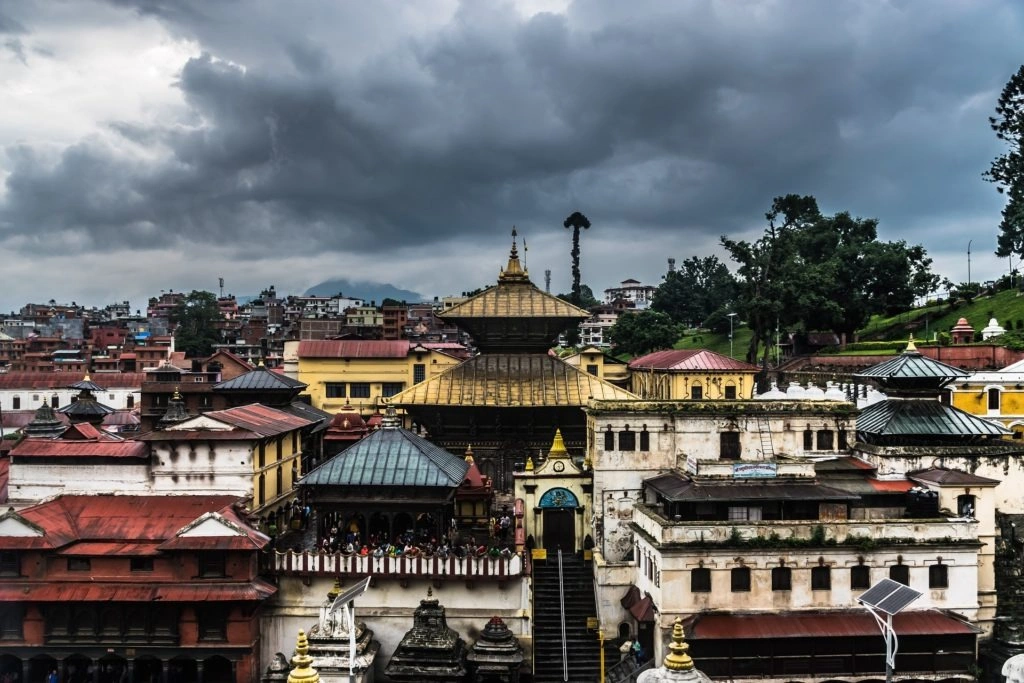
Pashupatinath Temple is the most sacred Hindu temple in Nepal and one of the most sacred Shiva pilgrimage sites in the world, located on the western bank of the Bagmati River, 5 km east of Kathmandu at 1,338 meters elevation. UNESCO inscribed it in 1979 for its 5th-century CE origins, Pagoda architecture, and its unbroken role as a living Hindu pilgrimage site for 1,600+ years.
Pashupati combines 2 Sanskrit words: paśu (living beings) and pati (lord), translating as "Lord of All Living Beings." This is one of the 8 principal names of Shiva in Shaivite Hinduism. The temple functions as the primary site of Hindu cremation in Nepal, with 11 cremation ghats (platforms) on the Bagmati riverbank processing 50–80 cremations daily.
What Is the History and Origin of Pashupatinath Temple?
Pashupatinath Temple was established in the 5th century CE during the Licchavi dynasty, with the first confirmed historical reference appearing in the Changu Narayan inscription of King Manadeva I (464 CE). The current 2-story pagoda structure was built in 1696 CE by King Bhupalendra Malla after the original temple was destroyed by white ants (Macrotermes termites). The temple complex covers 264 hectares, containing 518 subsidiary temples, shrines, and buildings across the eastern and western banks of the Bagmati River.
The principal Shivalinga (sacred phallic symbol of Shiva) inside the main sanctum is 1 meter tall with 4 carved silver faces on its 4 sides, the Chaturmukhi Lingam. Each face represents 1 of Shiva's 4 aspects: Sadyojata (west), Vamadeva (north), Tatpurusha (east), and Aghora (south). Only Hindu worshippers enter the main temple; non-Hindus view the exterior from the east bank of the Bagmati River.
What Is the Religious Significance of the Bagmati River at Pashupatinath?
The Bagmati River, originating at Baghdwar spring in the Shivapuri hills at 1,528 meters elevation, is considered sacred in Hindu tradition because it joins the Ganges River system 200 km downstream in Bihar, India. Hindus believe cremation on the Bagmati ghats at Pashupatinath grants direct liberation (moksha) from the cycle of rebirth. The Maha Shivaratri festival, held annually on the 13th/14th night of the Hindu month Phalguna (February–March), draws 500,000–1,000,000 Hindu pilgrims to Pashupatinath from Nepal and India. For a complete look at its ritual calendar, architectural layout, and visitor information, see our dedicated Pashupatinath Temple guide.
6. Patan Durbar Square
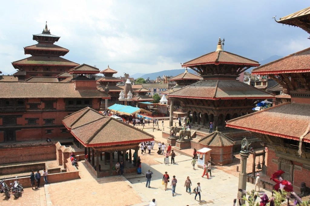
Patan Durbar Square is the royal palace complex of Lalitpur (Patan) city, located 5 km south of Kathmandu in Lalitpur Metropolitan City at 1,337 meters elevation, inscribed by UNESCO in 1979 for its 17th-century Malla palace courtyards, 3 primary Hindu temples, and the Patan Museum, recognized as 1 of the finest museums in Asia for medieval South Asian art.
Lalitpur derives from Sanskrit: lalit (beautiful, elegant) and pur (city), translating as "City of Fine Arts." Patan is the oldest of the 3 royal cities of the Kathmandu Valley, established by Licchavi rulers between the 3rd century BCE and 4th century CE. The city is also associated with Emperor Ashoka, who visited c. 250 BCE and reputedly constructed 4 of the Buddhist stupas (Ashoka Stupas) that still stand at the 4 cardinal points of the city.
What Are the 3 Principal Temples of Patan Durbar Square?
The 3 principal temples are Krishna Mandir, Bhimsen Temple, and Vishwanath Temple.
Krishna Mandir: Built in 1637 CE by King Siddhi Narsingh Malla, Krishna Mandir is a 3-story shikhara (North Indian spire-style) temple with 21 gilded pinnacles. The temple is constructed entirely from stone, a rare departure from the brick-and-wood Newari style, and contains a 2nd-story frieze depicting 18 battle scenes from the Mahabharata and Ramayana epics.
Bhimsen Temple: A 3-story rectangular temple built in 1680 CE, dedicated to Bhimsen, the Newari deity of trade and commerce. The ground floor serves as an open market; the upper floors house the deity's sanctum.
Vishwanath Temple: A 2-story pagoda built in 1627 CE by King Siddhi Narsingh Malla, dedicated to Shiva. The temple contains 2 large stone elephants flanking the entrance stairway and an explicit erotic frieze carved on the roof struts, a traditional apotropaic device used in Newari religious architecture.
What Makes the Patan Museum Significant?
The Patan Museum, housed in the restored west wing of the Patan Royal Palace (Mul Chowk), opened in 1997. It contains 1,283 catalogued objects spanning 1,800 years of Nepali art, organized across 11 galleries. The collection includes 4 principal categories: gilt copper repoussé sculptures, cast bronze deities, stone carvings, and woodwork. The museum building itself is a 17th-century Malla palace courtyard, the museum interior is an exhibit of Malla architecture as much as it is a collection space. CNN Travel ranked it among the top 10 museums in Asia in 2018.
7. Swayambhunath Stupa
Swayambhunath Stupa is one of the oldest and most sacred Buddhist pilgrimage sites in Nepal, located on a conical hill 77 meters above the western edge of Kathmandu Valley floor at 1,336 meters elevation, inscribed by UNESCO in 1979. The stupa is 2,500 years old, contains 365 stone steps on its eastern approach, and is popularly known as the "Monkey Temple" due to the 500+ resident rhesus macaques (Macaca mulatta) that live on the hilltop.
Swayambhu derives from Sanskrit: svayam (self) and bhū (arisen or manifested), meaning "Self-Created" or "Self-Existent." The name refers to the legend that the stupa's flame arose spontaneously from a lotus flower growing in the prehistoric Kathmandu Lake before the valley was drained. Swayambhunath is sacred to both Buddhists and Hindus, it is one of 3 major UNESCO Heritage Sites in Nepal considered a shared pilgrimage destination for both religions.
What Is the History and Architectural Structure of Swayambhunath Stupa?
Swayambhunath Stupa was originally constructed in the 5th century CE, with the earliest documented reference appearing in an inscription from the reign of King Vrishadeva (c. 460 CE). The stupa has 3 primary architectural components: the hemispherical dome (anda), the square harmika tower with the all-seeing Buddha eyes, and the 13-ringed tapering spire (yasti). The anda measures 20 meters in diameter. The 4 sides of the harmika bear painted eyes of Buddha, identical in design to the eyes at Boudhanath Stupa.
The hilltop complex contains 5 additional religious structures beyond the main stupa: the Anantapur Temple (Hindu, 17th century), Pratappur Temple (Hindu, 17th century), the Shantipur Temple (Buddhist, 10th century), the Manjushri Shrine, and the Harati Devi Temple. A total of 12 major restoration projects have been conducted at Swayambhunath between 1921 and 2020.
Why Is Swayambhunath Stupa Associated with Manjushri?
Manjushri, the Bodhisattva of wisdom in Mahayana Buddhism, is directly associated with Swayambhunath through the foundational myth of the Kathmandu Valley. According to the Swayambhu Purana (the primary Buddhist text describing the valley's origin), Manjushri drained the prehistoric Kathmandu Lake by cutting the gorge at Chobar with his sword, making the valley habitable. Swayambhunath, the self-arisen flame on the lotus, was the sacred site Manjushri came to worship. This myth connects Swayambhunath to the cosmological founding of the Kathmandu Valley civilization.
8. Lumbini
Lumbini is the birthplace of Gautama Buddha, born Siddhartha Gautama, located in Rupandehi District, Lumbini Province, in the southern Terai plains of Nepal at 113 meters elevation, 22 km north of the Indian border. UNESCO inscribed Lumbini in 1997 for its direct association with the birth of Buddhism, one of the world’s major religions, practiced by 535 million people across 50 countries.
Lumbini derives from Sanskrit, referring to the grove of sala trees (Shorea robusta) in which Queen Mayadevi gave birth to Siddhartha Gautama. The Buddhist tradition dates this birth to 623 BCE (Theravada calendar) or 563 BCE (scholarly consensus). The discrepancy of 60 years reflects 2 competing Buddhist chronologies: the "long chronology" of Sri Lanka and Southeast Asia and the "corrected chronology" used in modern academic historiography.
What Is the Archaeological Evidence for Buddha's Birthplace at Lumbini?
The primary archaeological evidence is the Ashoka Pillar, erected 249 BCE by Emperor Ashoka of the Maurya Empire during his pilgrimage to Lumbini. The pillar's inscription, carved in Brahmi script and Pali language, reads: "Hida Budhe jāte Sakyamuni" ("Here the Buddha, sage of the Shakyas, was born"). The pillar stands 6.4 meters above ground with an additional 3.6 meters buried below the surface, totaling 10 meters in height and 2.08 meters in circumference.
The Maya Devi Temple, built directly over the nativity site, contains a sandstone bas-relief from the 3rd century BCE depicting Queen Mayadevi giving birth to Siddhartha while holding a sal tree branch. A 2013 excavation by Durham University and the Nepal Department of Archaeology uncovered a 6th-century BCE timber structure beneath the temple foundations, the oldest confirmed Buddhist shrine in the world, predating the Ashokan structures by 300 years.
What Is the Layout of the Lumbini Sacred Garden?
The Lumbini Development Zone, designed by Japanese architect Kenzo Tange in 1978, covers 4.8 square kilometers organized around a central axis canal 4.8 km long. The zone divides into 3 concentric areas: the Sacred Garden (innermost, containing Maya Devi Temple and Ashoka Pillar), the Monastic Zone (containing 28 international Buddhist monasteries representing 14 countries), and the New Lumbini Village (tourism infrastructure). Lumbini welcomed a record 1,172,304 domestic and international visitors in 2024, a 17.36% rise from 2023, according to the Lumbini Development Trust, comprising nearly 760,000 domestic tourists and more than 415,000 foreign visitors, led by record Indian arrivals.
9. Chitwan National Park: World Heritage Sites
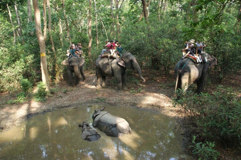
Chitwan National Park is Nepal's first and oldest national park, established in 1973 and inscribed by UNESCO in 1984 for its exceptional biodiversity, specifically its populations of greater one-horned rhinoceros (Rhinoceros unicornis) and Bengal tiger (Panthera tigris tigris), both classified as vulnerable species on the IUCN Red List. The park covers 952.63 sq km in the inner Terai lowlands of Chitwan and Nawalpur Districts at elevations between 100 and 815 meters.
Chitwan derives from two Nepali words: chitta (heart or mind) and van (forest), translating as "Heart of the Jungle." The area served as a royal hunting reserve for Nepal's Shah dynasty from 1846 until 1964, when hunting was banned and the land was converted to a rhinoceros sanctuary. The sanctuary received national park status in 1973 under the National Parks and Wildlife Conservation Act.
What Wildlife Species Does Chitwan National Park Protect?
Chitwan National Park protects 68 mammal species, 544 bird species, 56 herpetofauna species (amphibians and reptiles), and 126 fish species in 4 distinct habitat types: sal forest, mixed riverine forest, grasslands (including 2-meter-tall Saccharum spontaneum elephant grass), and oxbow lakes.
The 4 flagship species are:
Greater One-Horned Rhinoceros: A population of 694 individuals as of the 2021 Nepal Rhinoceros Census, representing 92% of Nepal's national total, according to the National Trust for Nature Conservation's 2021 National Rhino Count. This marks an increase from 645 in 2015 nationally, with Chitwan alone accounting for 89 of the 107 new rhinos counted.
Bengal Tiger: 145 adult tigers recorded in Chitwan as of Nepal's fifth National Tiger Survey (released July 2026), the highest count of any of the country's five tiger-bearing protected areas and part of a national population of 429, more than triple the 121 tigers Nepal held in 2009.
Gharial Crocodile (Gavialis gangeticus): A critically endangered species with fewer than 650 mature adults globally. Chitwan's Rapti and Narayani rivers support a breeding population of 100+ gharials.
Asian Elephant (Elephas maximus): A resident and migratory population of 50–80 elephants, using the Chitwan-Parsa-Valmiki transboundary corridor.
What Ecosystem Services Does Chitwan National Park Provide?
Chitwan National Park provides 3 documented ecosystem services to Nepal's Terai region. The park's forests and wetlands store 31.6 million metric tons of carbon (measured by the Wildlife Conservation Society, Nepal, in 2019). The Rapti, Reu, and Narayani rivers originating from the park's watershed supply irrigation water to 63,000 hectares of agricultural land in the surrounding Chitwan and Nawalpur Districts. The park's buffer zone supports 39 Village Conservation Committees managing 753 sq km of community forests, a model replicable across the global Protected Area network. Travelers can experience these ecosystems firsthand on a Chitwan jungle safari, with guided wildlife encounters covering rhinos, tigers, and gharial crocodiles across the park's riverine and grassland habitats.
10. Sagarmatha National Park: World Heritage Sites
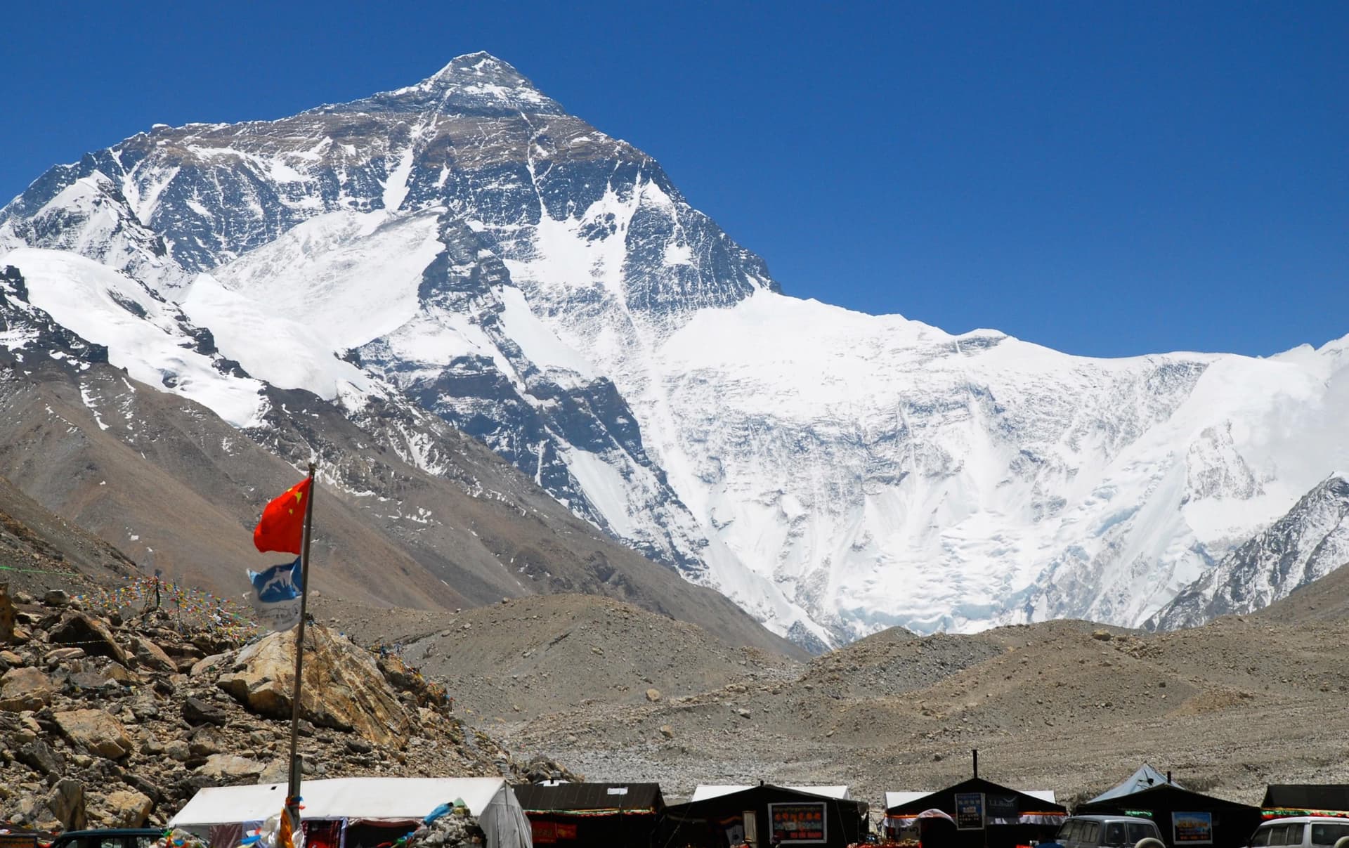
Sagarmatha National Park is a high-altitude protected area containing Mount Everest (8,848.86 meters), the highest point on Earth, located in Solukhumbu District, Koshi Province, northeastern Nepal, established in 1976 and inscribed by UNESCO in 1979 for its outstanding natural landscape, unique glacial ecology, and presence of several peaks exceeding 7,000 meters. The park covers 1,148 sq km at elevations ranging from 2,845 to 8,848.86 meters.
Sagarmatha is the Nepali name for Mount Everest, derived from Sanskrit: sāgara (sky/heaven) and māthā (head/forehead), meaning "Head of the Sky." The mountain is called Chomolungma in Tibetan, meaning "Goddess Mother of the World." The English name Everest honors Sir George Everest, the British Surveyor General of India who standardized the trigonometric survey of the Indian subcontinent between 1830 and 1843. The mountain's exact height, 8,848.86 meters, was established by a joint Nepal-China survey completed in December 2020.
What Is the Geological Origin of Sagarmatha National Park?
Sagarmatha National Park formed through the collision of the Indian Plate and Eurasian Plate, a tectonic event that began 50 million years ago and continues at a convergence rate of 44–50 mm per year. The Himalayas, including Mount Everest and the 7 other peaks above 7,000 meters within the park (Lhotse at 8,516 m, Cho Oyu at 8,188 m, Makalu at 8,485 m bordering the park, Pumori at 7,161 m, Ama Dablam at 6,812 m, Thamserku at 6,623 m, and Kangtega at 6,779 m), are still rising at 5 mm per year as the Indian Plate continues subducting beneath the Eurasian Plate.
The park contains 19 glaciers covering 27% of the total park area (309.96 sq km). The Khumbu Glacier, the world's highest glacier at a base elevation of 4,900 meters, extends 17 km in length and supplies meltwater to the Dudh Koshi River system serving 3 districts of eastern Nepal.
What Wildlife and Vegetation Does Sagarmatha National Park Contain?
Sagarmatha National Park contains 3 distinct vegetation zones and 118 bird species, 26 mammal species, and 6 reptile species adapted to high-altitude Himalayan ecology.
The 3 vegetation zones are:
Sub-alpine zone (2,845–3,500 m): Birch (Betula utilis), rhododendron (Rhododendron arboreum), and blue pine (Pinus wallichiana) forests. Contains 20% of Nepal's known orchid species.
Alpine zone (3,500–5,000 m): Dwarf juniper (Juniperus recurva), scrub rhododendron, and alpine meadows.
Nival zone (5,000–8,848 m): Rock, ice, and permanent snow. No vascular vegetation; only lichen and bacteria documented above 6,000 meters.
The 3 flagship mammals are the snow leopard (Panthera uncia, estimated 25–35 individuals in the park), red panda (Ailurus fulgens, listed as vulnerable), and Himalayan tahr (Hemitragus jemlahicus, a resident ungulate population of 700+).
What Is the Cultural Significance of Sagarmatha National Park to the Sherpa Community?
The Sherpa people, a Tibeto-Burman ethnic group who migrated from the Kham region of eastern Tibet approximately 500 years ago, are the indigenous community of the Khumbu Valley within the park. Approximately 3,500 Sherpas permanently reside in 8 villages (Namche Bazaar, Khumjung, Kunde, Thame, Phortse, Pangboche, Dingboche, and Lobuche) within the park boundaries. Sherpas practice Tibetan Nyingma Buddhism; the Tengboche Monastery (3,867 m), founded in 1916 CE and rebuilt after a 1989 fire, is the most important religious institution in the Khumbu region.
Tenzing Norgay Sherpa and Sir Edmund Hillary made the first confirmed ascent of Mount Everest on 29 May 1953 at 11:30 AM local time. As of the close of the 2024 climbing season, Mount Everest had been summited 12,884 times by 7,269 unique climbers since the first ascent in 1953, according to the International Climbing and Mountaineering Federation (UIAA), which also records 335 climbing deaths on the mountain since 1923. The annual climbing season runs April–May (spring) and September–October (autumn), with Nepal charging a USD 15,000 permit fee per climber for the south-side route.
Summary: Nepal's 10 UNESCO World Heritage Sites at a Glance
Nepal’s 4 UNESCO World Heritage properties span 3 inscription years and include 10 major monument zones and protected areas: 1979 (7 sites, Sagarmatha National Park and 7 Kathmandu Valley monuments), 1984 (Chitwan National Park), and 1997 (Lumbini). Together, these 10 sites represent 3 dimensions of Nepal's global significance: its 2,500-year Hindu and Buddhist religious heritage concentrated in the Kathmandu Valley, the ecological biodiversity of its Terai lowlands at Chitwan, and the geological and mountaineering heritage of the Himalayas at Sagarmatha. Nepal's World Heritage Sites collectively receive 3.5 million visitors annually, generating NPR 45 billion (approximately USD 339 million) in tourism revenue, 5.6% of Nepal's gross domestic product. To explore the Sagarmatha heritage zone and trek through the world's highest national park, consider our guided Everest Base Camp trek, the most direct way to experience Nepal's UNESCO mountain heritage up close.