Nepal is one of the most geographically concentrated high-altitude trekking destinations in the world, where the Himalayan range rises from subtropical river valleys into some of the planet’s highest alpine environments within a single journey. Home to Nepal and peaks such as Everest, Annapurna, and Manaslu, the country offers a rare trekking ecosystem shaped by extreme elevation gain, diverse climatic zones, and deeply rooted mountain cultures. Trails pass through UNESCO-listed conservation areas, glacier-fed valleys, and centuries-old trade and pilgrimage corridors, making route selection a critical part of the trekking experience rather than a simple matter of preference.
The five most important trekking destinations, Everest Region, Annapurna Region, Langtang Region, Manaslu Circuit Trek, and restricted or remote corridors such as Upper Mustang Trek, each deliver fundamentally different trekking conditions in terms of altitude progression, permit requirements, trail density, and cultural exposure. Understanding these regions is essential for matching trekking difficulty, available time, and acclimatization capacity with the right Himalayan environment, since Nepal’s routes are not interchangeable but structurally distinct high-altitude systems that demand precise planning.
What Are the Main Trekking Regions to Know in Nepal?
Nepal's trekking geography is divided into 5 primary regions: the Everest (Khumbu) region in the northeast, the Annapurna massif in the north-central zone, the Langtang corridor north of Kathmandu, the Manaslu Circuit in the west-central highlands, and a cluster of restricted-access wilderness zones encompassing Upper Mustang, Dolpo, Nar Phu, and Kanchenjunga. Each region operates under a distinct permit system, trail infrastructure standard, and altitude profile.
What Are the Top Trekking Regions in Nepal?
The 5 top trekking regions in Nepal are the Everest region (Khumbu), the Annapurna region, the Langtang region, the Manaslu Circuit, and the off-the-beaten-path zones including Upper Mustang, Dolpo, and Nar Phu Valley.
Each region serves a distinct trekker profile:
-
Everest region: iconic 8,848.86 m peak, highest concentration of high-altitude trails, best teahouse infrastructure above 4,000 m
-
Annapurna region: most diverse landscapes in a single circuit, the world's most-trekked long-distance trail, elevations between 800 m and 5,416 m
-
Langtang region: closest major trekking zone to Kathmandu (7 hours by road), rare Tamang cultural access, rapid elevation gain
-
Manaslu Circuit: restricted-area permit required, lower trail traffic than Everest and Annapurna, circumnavigates the world's 8th-highest peak at 8,163 m
-
Off-the-beaten-path zones: Upper Mustang, Dolpo, Nar Phu, and Kanchenjunga require special restricted area permits, deliver 90% fewer fellow trekkers than major routes
What most trekking guides miss: Nepal's regions are not interchangeable stepping stones. The Langtang region, for example, reaches 5,000 m+ in under 4 days from Syabrubesi, a vertical gain profile more aggressive than many Everest Base Camp itineraries. Matching region to acclimatization pace is as important as matching it to scenery preference.
How Do You Choose the Right Trekking Region in Nepal?
Choose the right trekking region in Nepal by evaluating 4 primary variables: your available trekking days, your highest altitude experience, your permit eligibility, and your trail infrastructure preference.
The table below maps each factor to the appropriate region:
|
Variable |
Everest |
Annapurna |
Langtang |
Manaslu |
Off-the-Beaten-Path |
|
Minimum days (full route) |
12–14 |
15–21 |
7–10 |
14–18 |
18–28 |
|
Max altitude (standard route) |
5,364 m (EBC) |
5,416 m (Thorong La) |
5,000 m (Tserko Ri) |
5,160 m (Larkya La) |
Up to 5,360 m+ |
|
Trail density (teahouses) |
High |
Very High |
Moderate |
Low–Moderate |
Very Low |
|
Restricted permit required |
No |
No |
No |
Yes |
Yes |
|
Best for solo trekkers |
Yes |
Yes |
Yes |
No (guide mandatory) |
No (guide mandatory) |
The decision point most trekkers face incorrectly: time versus altitude. Annapurna Circuit demands more days than Everest Base Camp but covers a far more varied elevation band. Trekkers with 10 days who feel drawn to the Annapurna Circuit consistently over-estimate what's achievable and end with incomplete routes. The Langtang region or a shorter Annapurna variant, Poon Hill or the Annapurna Base Camp route, fits that window better.
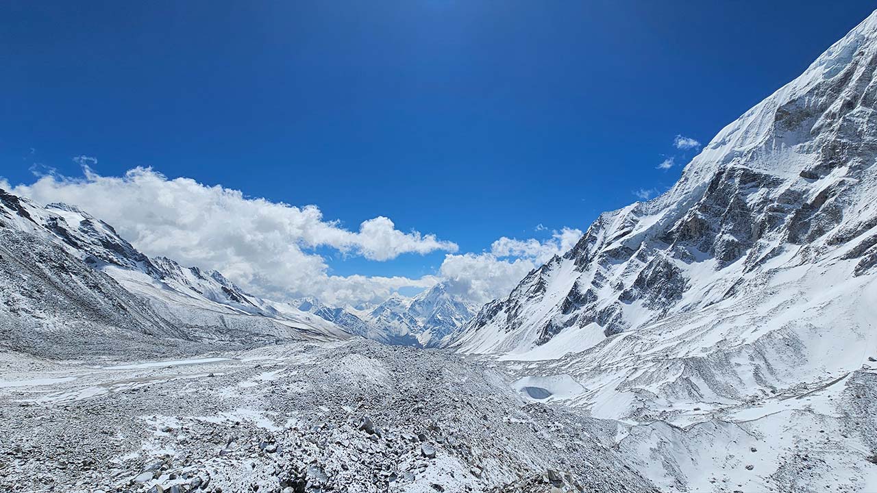
1. Everest Region
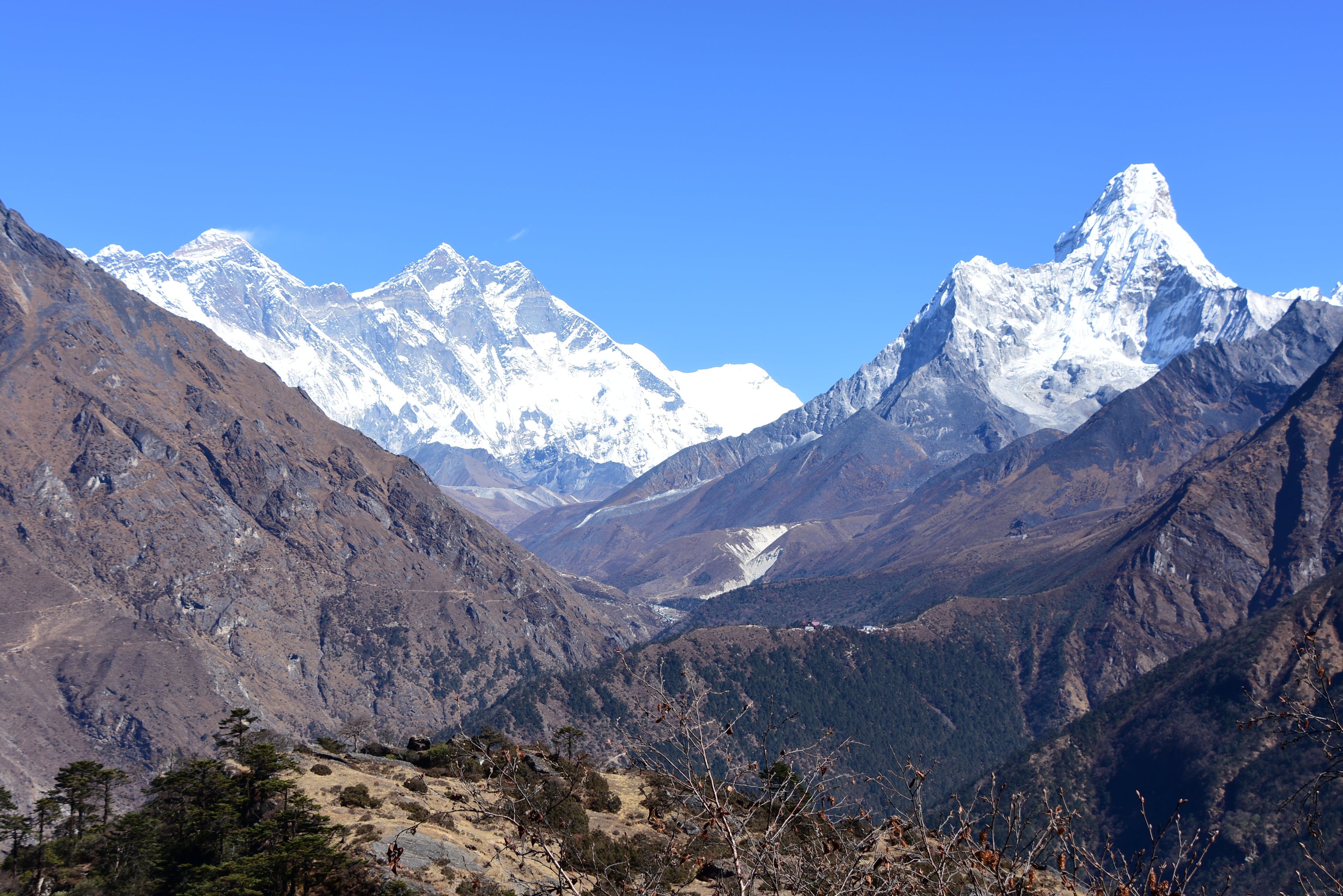
The Everest region, formally named the Khumbu region, occupies the Solukhumbu district of eastern Nepal. It borders Tibet to the north and contains Sagarmatha National Park, a UNESCO World Heritage Site since 1979 covering 1,148 km². The region hosts Mount Everest (8,848.86 m), Lhotse (8,516 m), Makalu (8,485 m), and Cho Oyu (8,188 m) within a 60 km radius.
What Makes Everest Region Trekking So Popular?
Everest region trekking draws over 50,000 trekkers annually because it delivers verified proximity to the world's highest mountain via a well-established teahouse trail system, with the Everest Base Camp trek serving as the primary route to a universally recognized destination.
The Everest region's popularity rests on 4 structural advantages:
-
Name recognition: "Everest Base Camp" functions as a global bucket-list benchmark. No other trek carries equivalent aspirational weight.
-
Proven infrastructure: Teahouses operate continuously along the trail from Lukla (2,840 m) to Gorak Shep (5,164 m), with lodges at every major stop: Namche Bazaar, Tengboche, Dingboche, Lobuche.
-
Flight access; Tenzing-Hillary Airport in Lukla (2,840 m) cuts 7–8 days of walking approach. Most trekkers fly from Kathmandu in 35 minutes.
-
Sherpa cultural depth: The Khumbu region is the ancestral homeland of the Sherpa people, with Tengboche Monastery (3,867 m) offering one of Asia's most visually dramatic monastic settings.
What competitors typically overlook: the Everest region offers compelling secondary viewpoints beyond EBC. Kala Patthar (5,645 m) delivers a cleaner, more complete Everest panorama than Base Camp itself because EBC sits below the Khumbu Icefall and offers no direct summit view. Most trekkers who have done both rate Kala Patthar as the superior visual reward.
Which Everest Treks Suit Beginners and Advanced Trekkers?
The 3 primary Everest region treks, ranked by difficulty, are the Everest Base Camp Trek (moderate–challenging), the Three Passes Trek (challenging–strenuous), and the Gokyo Lakes Trek (moderate–challenging).
For beginners and intermediate trekkers:
The Everest Base Camp Trek (12–16 days, max altitude 5,364 m) is the standard entry point. It follows a defined trail with accommodation every 2–4 hours of walking, mandatory acclimatization stops at Namche Bazaar (3,440 m) and Dingboche (4,410 m) built into the itinerary, and descent to lower altitude each night where possible.
Key preparation benchmark: trekkers who complete EBC comfortably average 5–7 hours of daily walking at sustained gradients. Prior high-altitude experience above 3,500 m significantly reduces acute mountain sickness (AMS) risk.
For advanced trekkers:
The Three Passes Trek (18–21 days) crosses 3 high passes, Kongma La (5,535 m), Cho La (5,420 m), and Renjo La (5,360 m), and requires technical snow and ice traversal on Cho La during early spring and late autumn seasons. It combines EBC, Gokyo Lakes, and the Kongma La corridor into a single demanding loop.
The Gokyo Lakes Trek (12–16 days, max altitude 5,357 m at Gokyo Ri) suits trekkers who prioritize wilderness over the main EBC trail crowd. The Gokyo Valley holds 6 turquoise glacial lakes above 4,700 m and sees approximately 40% fewer trekkers than the EBC main route.
Permit requirements for Everest region treks:
-
Sagarmatha National Park Entry Permit: NPR 3,000 (~USD 22) per person
-
Khumbu Pasang Lhamu Rural Municipality Permit: NPR 2,000 (~USD 15) per person
-
TIMS Card (Trekkers' Information Management System): NPR 2,000 for individual trekkers
2. Annapurna Region
The Annapurna region encompasses the Annapurna Conservation Area (ACAP), Nepal's largest protected area at 7,629 km², spanning the Kaski, Manang, Mustang, and Myagdi districts. The region contains Annapurna I (8,091 m), the world's 10th-highest peak, along with Dhaulagiri (8,167 m), Machhapuchhre (6,993 m), and Nilgiri (7,061 m).
Why Is the Annapurna Region Famous for Trekking?
The Annapurna region is famous for trekking because it concentrates the greatest ecological and cultural diversity of any single trekking zone in Asia, with trails spanning subtropical rice terraces at 1,000 m, Rhododendron forests at 2,800 m, high alpine desert at 4,500 m, and Tibetan Buddhist landscapes at 5,400 m, all within one connected trail network.
3 factors define the Annapurna region's reputation:
-
The Annapurna Circuit: at 160–230 km, it holds status as one of the world's classic long-distance trekking routes, crossing the Thorong La pass (5,416 m), the highest trekked mountain pass on Earth
-
Accessibility: Pokhara (820 m), the Annapurna region's gateway city, sits 200 km from Kathmandu with daily flights and 7-hour bus connections; no internal flight required to begin trekking
-
Teahouse density: the Annapurna region supports over 1,000 registered teahouses, the highest density of any Nepal trekking zone, making it the most forgiving region for itinerary flexibility
The cultural dimension that separates Annapurna from Everest: the region hosts Gurung, Magar, Thakali, and Tibetan Buddhist communities within a single circuit. Manang village (3,519 m) and Kagbeni (2,810 m) deliver distinct architectural and religious landscapes that Everest's Sherpa-dominant cultural corridor does not replicate.
Which Annapurna Routes Are Most Recommended?
The 4 most recommended Annapurna trekking routes are the Annapurna Circuit (15–21 days), the Annapurna Base Camp Trek (10–13 days), the Poon Hill Trek (4–5 days), and the Mardi Himal Trek (6–8 days).
-
Annapurna Circuit Trek, Most comprehensive route. Begins at Besisahar (760 m) or Chame (2,710 m) by jeep, crosses Thorong La (5,416 m), descends to Muktinath (3,800 m), and exits through the Kali Gandaki gorge, the world's deepest gorge at 5,571 m depth. Road construction has shortened the classic route by approximately 40 km since 2010, but the Thorong La crossing and the Manang–Muktinath section retain full trail character.
-
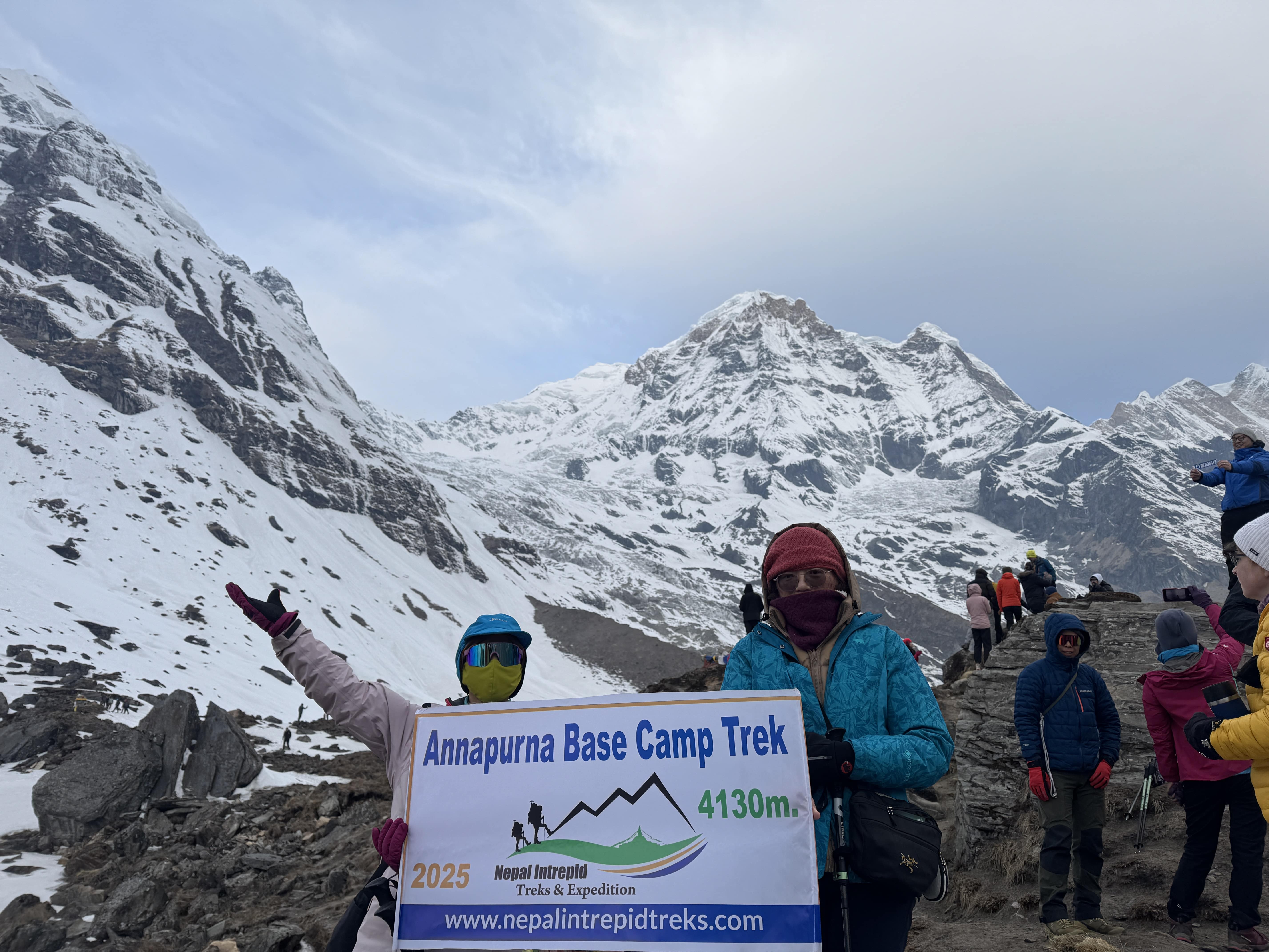
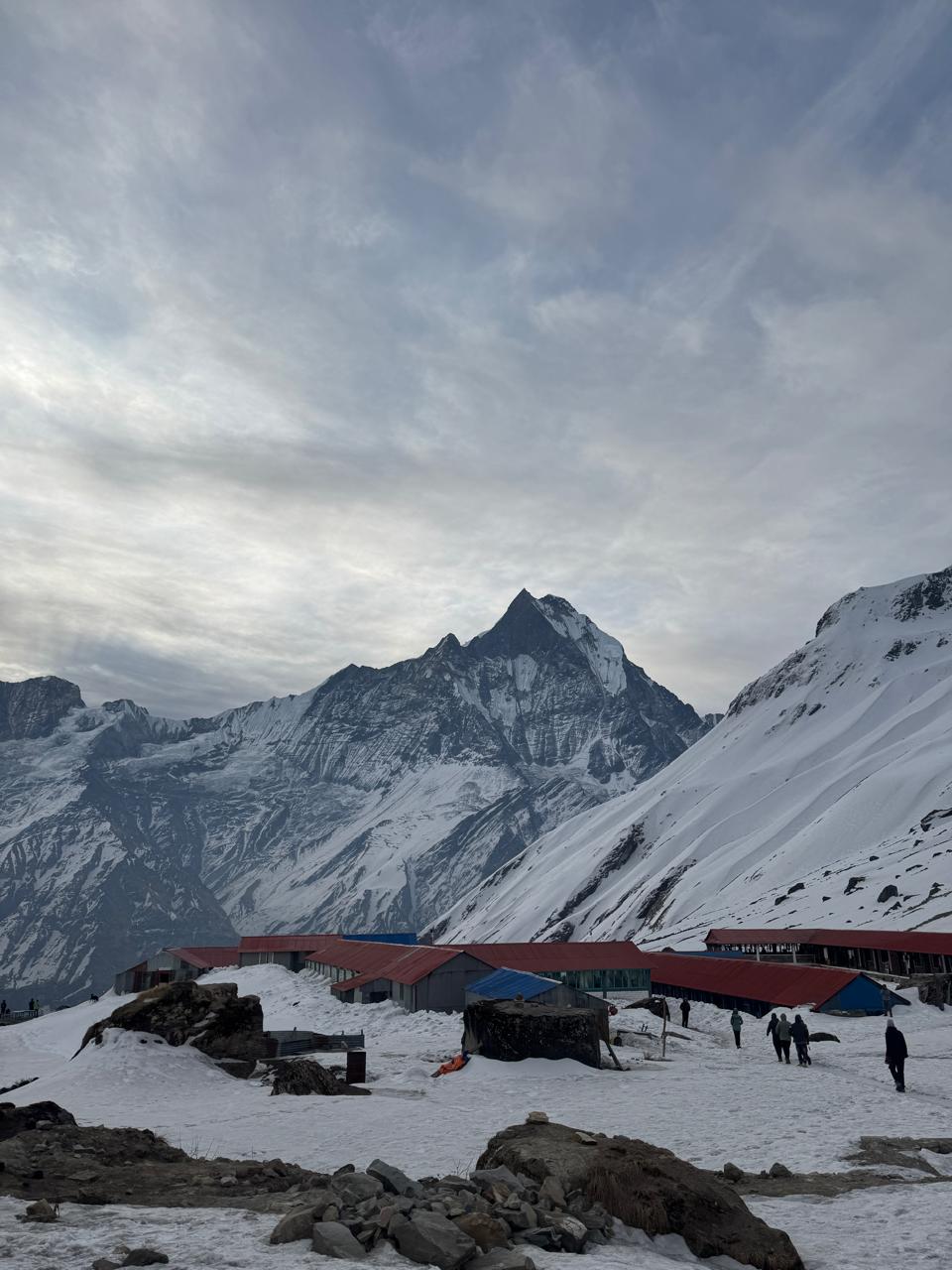
Annapurna Base Camp Trek (ABC), Most direct route to a high-altitude base camp in the region. Reaches Annapurna Base Camp at 4,130 m, surrounded by a 360-degree amphitheater of peaks including Annapurna I, Annapurna South (7,219 m), Hiunchuli (6,441 m), and Machhapuchhre. Passes through Ghorepani (2,874 m) and Chhomrong (2,170 m), the primary Gurung village on the route.
-
Poon Hill Trek, Best short-format option for first-time Nepal trekkers or those with limited days. Reaches Poon Hill viewpoint (3,210 m) for a sunrise panorama of the Dhaulagiri and Annapurna massifs. Completed in 4–5 days from Nayapul. No altitude risk for acclimatized lowland trekkers.
-
Mardi Himal Trek, Least-known among major Annapurna routes. Reaches Mardi Himal High Camp (4,500 m) with a direct face view of Machhapuchhre. Trail opened officially in 2012. Sees roughly 70% fewer trekkers than the ABC route with comparable peak views from the upper camp.
Permit requirement: ACAP (Annapurna Conservation Area Permit): NPR 3,000 (~USD 22). No restricted area permit required for standard routes.
3. Langtang Region
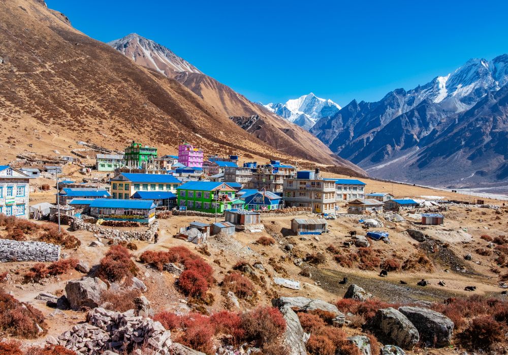
The Langtang region occupies the Rasuwa district, directly north of Kathmandu, bordering Tibet's Kyirong county. Langtang National Park, established in 1976 as Nepal's first Himalayan national park, covers 1,710 km². The region contains Langtang Lirung (7,227 m), Ganesh Himal (7,422 m), Dorje Lakpa (6,966 m), and the Gosaikunda sacred lake complex at 4,380 m.
What Are the Highlights of the Langtang Valley Trek?
The 5 principal highlights of the Langtang Valley Trek are the Kyanjin Gompa monastery complex (3,870 m), Tserko Ri summit viewpoint (4,984 m), the traditional Tamang village of Langtang (3,430 m), the Langtang Glacier and Lirung Glacier approach, and the Gosaikunda sacred lake, a Hindu pilgrimage site active since pre-medieval Nepal.
The Langtang Valley Trek follows the Langtang River gorge from Syabrubesi (1,460 m) to Kyanjin Gompa (3,870 m) across approximately 30 km of maintained trail. The elevation gain, over 2,400 m in 3 days, is steeper per-day than any equivalent section on the Everest Base Camp route.
What most trekkers underestimate about Langtang: post-earthquake terrain shifts. The 2015 Gorkha Earthquake triggered a catastrophic landslide that destroyed Langtang village and killed over 350 people. Rebuilt with international support, the new village sits on repositioned ground. Trail conditions between Langtang village and Kyanjin remain stable, but the landscape shows visible scar features on the northern valley wall that first-time visitors consistently find surprising and disorienting.
The Langtang Valley trek also provides access to Gosaikunda (4,380 m) via a 2-day side trail through Lauribina La pass (4,610 m). Gosaikunda is one of Nepal's most sacred Hindu lakes, mentioned in both the Mahabharata and Shiva Purana, and receives over 10,000 pilgrims during the Janai Purnima festival in August.
The Langtang-Helambu Circuit (12–14 days) connects the Langtang Valley to the Helambu region southeast of the park, completing a full loop without vehicle return. It crosses Lauribina La and Tharepati ridge (3,640 m) before descending to the Melamchi Valley.
When Is the Best Time to Trek in the Langtang Region?
The 2 optimal trekking seasons for the Langtang region are spring (mid-March to May) and autumn (October to mid-December). Both seasons deliver stable weather, clear mountain visibility, and open trail access.
-
Spring (March–May): Rhododendron forests between 2,500 m and 3,500 m peak at full bloom from late March through April. Average daytime temperatures at Kyanjin Gompa reach 8–12°C. Snow on Lauribina La clears by late April, opening the Gosaikunda side route. Trail conditions are consistently firm.
-
Autumn (October–December): Post-monsoon clarity produces the sharpest mountain views of the year. October delivers the clearest skies; November extends the season with colder but still stable conditions. Average daytime temperatures at Kyanjin Gompa drop to 2–6°C in November.
-
What to avoid: The monsoon season (June–September) brings 80% of Langtang's annual rainfall. Trail sections through the river gorge below Syabrubesi become prone to flash flooding and landslide activity. The gorge narrows significantly between Syabrubesi and Lama Hotel, making it the highest-risk section during heavy rain days.
-
Winter trekking (December–February): Possible but demands full cold-weather gear. Tserko Ri is accessible in clear winter conditions with crampons above 4,500 m. Teahouses in Kyanjin remain open year-round, but limited availability above Lama Hotel in January is typical.
Permit requirements for Langtang region treks:
-
Langtang National Park Entry Permit: NPR 3,000 (~USD 22)
-
TIMS Card: NPR 2,000 for individual trekkers
4. Manaslu Circuit Trek
The Manaslu Circuit Trek circumnavigates Mount Manaslu (8,163 m), the world's 8th-highest peak, in the Gorkha district of north-central Nepal. The route covers approximately 177 km and crosses the Larkya La pass (5,160 m), the highest mandatory pass on any standard circuit trek in Nepal. The Manaslu Conservation Area (1,663 km²) was established in 1998 and borders the Annapurna Conservation Area to the west, creating one of Nepal's largest contiguous protected landscapes.
Why Choose the Manaslu Circuit Trek Over Other Routes?
Choose the Manaslu Circuit trek over other routes when you prioritize low trail density, restricted-access cultural zones, and a complete 8,000 m peak circumnavigation, 3 attributes no other standard Nepal circuit provides simultaneously.
The core distinction: Manaslu Circuit sees approximately 4,000–6,000 trekkers annually, compared to Everest Base Camp's 50,000+ and the Annapurna Circuit's 80,000+. Trail solitude on Manaslu is structural, not seasonal, the mandatory restricted area permit system limits daily trekker volume by design.
5 specific advantages of the Manaslu Circuit over competing routes:
-
Unobstructed Manaslu views: the circuit's north side, between Samagaon (3,520 m) and Samdo (3,875 m), delivers face-on Manaslu views at under 5 km distance that no Annapurna or Langtang trail replicates
-
Nubri and Tsum Valley culture: the upper Budhi Gandaki corridor preserves Tibetan Buddhist communities, including the Pungyen Gompa monastery above Samagaon (est. 15th century), inaccessible from any other standard Nepal trek
-
Physical Larkya La crossing: at 5,160 m, the pass crossing demands a genuine high-altitude pre-dawn departure (typically 3–4 AM) with a 7–9 hour crossing day, delivering a summit-day-style experience without technical climbing
-
Connection to Annapurna Circuit: the Manaslu route connects directly to the Annapurna Circuit at Dharapani (1,860 m), enabling a 28–32 day combined mega-circuit for trekkers with extended time
-
Lower commercial saturation: teahouses exist but the lodge culture is significantly less commoditized than Everest and Annapurna; interactions with local Nubri families remain genuinely non-transactional in character
What Permits Are Required for Manaslu Region Treks?
3 mandatory permits are required for the Manaslu Circuit Trek: the Manaslu Restricted Area Permit (RAP), the Manaslu Conservation Area Permit (MCAP), and the Annapurna Conservation Area Permit (ACAP) for the section from Dharapani to Besisahar.
Manaslu Restricted Area Permit (RAP):
-
Cost: USD 100 per person for the first 7 days; USD 15 per person per additional day
-
Season-specific: September–November and March–May rates apply as above; December–February rate is USD 75 for the first 7 days
-
Requirement: must be obtained in Kathmandu through a registered trekking agency; cannot be obtained independently at the trailhead
-
Guide mandatory: solo unguided trekking is prohibited in the Manaslu restricted zone; a registered Nepali guide is legally required
Manaslu Conservation Area Permit (MCAP):
-
Cost: NPR 3,000 (~USD 22) per person
-
Obtained at Nepal Tourism Board offices in Kathmandu or Gorkha checkpoint
Annapurna Conservation Area Permit (ACAP):
-
Cost: NPR 3,000 (~USD 22) per person
-
Required for the Dharapani–Besisahar exit section
The Tsum Valley extension, a 2-week cultural side trek north of Samagaon into the Tsum Valley, requires an additional Tsum Valley Restricted Area Permit at USD 40 per person per week. Tsum Valley remains one of Nepal's most culturally preserved Buddhist valleys and sees fewer than 2,000 visitors annually.
5. Off-the-Beaten-Path Treks in Nepal
Nepal's restricted-area trekking zones hold the country's most pristine Himalayan landscapes. The 4 primary off-the-beaten-path destinations are Upper Mustang (former Forbidden Kingdom), Upper Dolpo (trans-Himalayan wilderness), Nar Phu Valley (hidden glacial corridor north of Annapurna), and Kanchenjunga Base Camp (remote eastern Nepal, third-highest peak on Earth).
What Are the Best Hidden Trekking Routes in Nepal?
The 4 best hidden trekking routes in Nepal are the Upper Mustang Trek (Forbidden Kingdom), the Dolpo Circuit (including Shey Phoksundo Lake), the Nar Phu Valley Trek, and the Kanchenjunga Circuit.
-
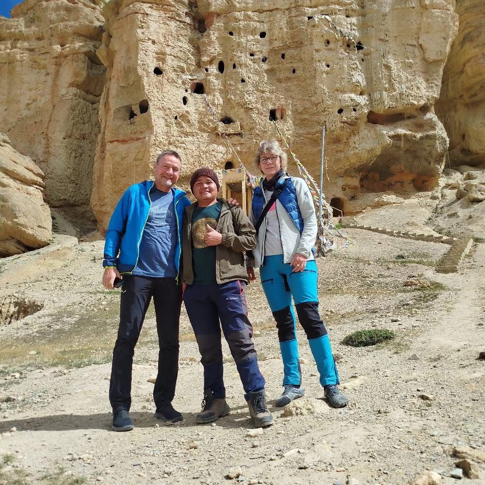
Upper Mustang Trek (17–21 days): Upper Mustang occupies the rain shadow north of the Annapurna and Dhaulagiri massifs, bordering Tibet at 3,800–4,500 m. The landscape is arid, ochre, and architecturally Tibetan, Lo Manthang, the walled capital (3,800 m), preserves 15th-century palace structures and cave monastery complexes inaccessible elsewhere in Nepal. Upper Mustang receives under 3,000 trekkers per year. The restricted area permit costs USD 500 for the first 10 days (USD 50 per additional day). A registered guide is mandatory.
-
Dolpo Circuit (21–28 days): Upper Dolpo, the setting for Peter Matthiessen's The Snow Leopard, contains Shey Phoksundo Lake (3,611 m), Nepal's deepest lake at 145 m depth and one of Asia's most dramatically blue alpine lakes. The route crosses 4 passes above 5,000 m and reaches Shey Gompa (4,200 m), a monastery functioning continuously since the 8th century. Restricted area permit: USD 500 for the first 10 days. Lower Dolpo has a lower permit tier at USD 30 per week.
-
Nar Phu Valley Trek (12–15 days): Nar Phu Valley branches north from the Annapurna Circuit at Koto (2,600 m) and penetrates a hidden glacial corridor ending at Nar village (4,200 m) and Phu village (4,080 m). The two villages hold fewer than 200 permanent residents combined, maintaining a subsistence agro-pastoral culture unchanged in visible character for generations. The Kang La pass (5,320 m) connects Phu to the Manang Valley, enabling a circuit back to the Annapurna route. Permit cost: USD 90 per person per week.
-
Kanchenjunga Circuit (26–32 days): Kanchenjunga (8,586 m), Earth's third-highest peak, anchors Nepal's far-eastern Taplejung district. The circuit visits both the North Base Camp (5,143 m) and South Base Camp (4,780 m), crossing the Sele La pass complex (4,290 m). The region is home to the Limbu and Rai ethnic communities, Nepal's eastern highland peoples distinct in language, architecture, and ceremonial practice from Sherpa or Tamang cultures. Internal flight to Taplejung and a 2-day road approach precede the trailhead.
How Difficult Are Off-the-Beaten-Path Treks in Nepal?
Off-the-beaten-path treks in Nepal range from grade 4 (strenuous) for Upper Mustang to grade 5 (very strenuous–expedition-grade) for Upper Dolpo and the Kanchenjunga Circuit, with 3 primary difficulty factors: remote trail conditions, high-pass crossings above 5,000 m, and limited rescue infrastructure.
The difficulty profile for each route breaks down across 3 variables:
|
Route |
Max Altitude |
Days Without Medical Facility |
Rescue Helicopter Access |
|
Upper Mustang |
4,200 m (Thorong La bypass) |
5–7 days |
Moderate (Jomsom within 1 day) |
|
Upper Dolpo |
5,190 m (Kagmara La) |
10–14 days |
Limited (Juphal airstrip 2–4 days away) |
|
Nar Phu Valley |
5,320 m (Kang La) |
4–6 days |
Good (Manang within 1 day) |
|
Kanchenjunga |
5,143 m (North BC) |
8–12 days |
Limited (Taplejung 4–6 days away) |
The most common mistake trekkers make on off-the-beaten-path routes: underestimating trail finding difficulty. Unlike Everest and Annapurna, where trails are effectively paved by foot traffic, Dolpo and Kanchenjunga sections involve unmarked yak trails, river crossings with no bridge infrastructure, and route-finding decisions that require either a guide or serious navigation experience. GPS track accuracy on these routes is lower than on major corridors due to sparse mapping.
Physical benchmarks for readiness:
-
Completed at least 1 standard Nepal trek (EBC, ABC, or Langtang) previously
-
Trained consistently at 6–8 hours of daily movement with 15–20 kg pack weight
-
No AMS history above 4,000 m
-
Familiar with basic wilderness first aid, including AMS recognition and descent protocol
How Can You Plan Top Nepal Trekking Routes with Guided Support?
Planning top Nepal trekking routes with guided support requires matching your route selection, permit strategy, and guide qualification to the specific region's regulatory and logistical requirements before arrival in Nepal.
Can Guided Trekking Services in Nepal Help You Choose the Right Route?
Guided trekking services in Nepal directly improve route selection outcomes by providing 3 concrete inputs most independent trekkers cannot access reliably: real-time trail condition data, permit processing speed, and altitude-event emergency protocol execution.
The practical value of a qualified guide on major versus restricted routes differs significantly:
On standard routes (Everest, Annapurna, Langtang): A licensed guide, identifiable by Nepal Tourism Board (NTB) registration and guide license card, optimizes daily itineraries based on current teahouse availability and weather windows. On the EBC route during October peak season, Dingboche and Lobuche teahouses fill to capacity by 2 PM. Guides with established lodge relationships confirm beds in advance, preventing altitude-inappropriate emergency descents caused by no available accommodation.
On restricted-area routes (Manaslu, Nar Phu, Upper Mustang, Dolpo, Kanchenjunga): A registered guide is not optional, it is legally mandated. No independent trekker permit is issued for restricted zones. The guide also serves as the primary interpreter for Restricted Area Permit checkpoint interactions; 11 active checkpoints on the Manaslu Circuit require signature verification with the guide's license details.
When evaluating trekking agencies and guides, apply these 3 criteria:
-
NTB License verification: request the guide license number and verify on the NTB database (ntb.gov.np). Licensed guides complete a 45-day technical training program including wilderness first aid and altitude illness management.
-
Wilderness First Responder (WFR) certification: not legally required but present in high-quality guide services; indicates training in Gamow bag use (portable altitude chamber) and AMS/HACE/HAPE recognition protocols
-
Agency membership: agencies affiliated with TAAN (Trekking Agencies' Association of Nepal) operate under an industry code of conduct; membership is searchable on taan.org.np
Planning timeline benchmark: Book restricted-area treks (Manaslu, Upper Mustang, Dolpo) at minimum 4–6 weeks before departure for permit processing. Standard route permits (Everest, Annapurna, Langtang) are obtainable in Kathmandu within 1 business day at the NTB permit counter at Bhrikutimandap, Thamel.
What Are the Key Insights About Top Trekking Destinations in Nepal?
The 5 key insights about top trekking destinations in Nepal are: region-to-fitness matching determines success more than motivation, restricted zones deliver disproportionate value for experienced trekkers, seasonal timing affects trail quality more than scenery quality, permit costs are a small fraction of the total trek investment and should not drive route compromise, and the Langtang region remains consistently underestimated relative to its altitude, culture, and logistical efficiency.
-
Insight 1, Region-to-fitness matching: Nepal's trail difficulty is non-linear. Altitude gain per day, not total elevation, determines acclimatization risk. The Langtang Valley's 800 m gain on day 2 (Syabrubesi to Lama Hotel) and 900 m gain on day 3 (Lama Hotel to Langtang Village) outpaces the EBC route's gentlest stretches. Match region to your daily altitude gain tolerance, not just your ambition.
-
Insight 2, Restricted zones and value: Upper Mustang and Nar Phu Valley deliver the most culturally differentiated experiences in Nepal. Their USD 90–500 permit fees are structurally designed to limit volume, not to generate revenue. The wilderness and cultural quality per trekking day in these zones exceeds standard routes by a wide margin for experienced trekkers seeking genuine discovery.
-
Insight 3, Seasonal nuance: Spring and autumn are the correct broad-season recommendations, but within each season, the optimal window narrows to 6–8 weeks. Late October through mid-November on the Everest route consistently delivers the clearest skies of the year. Late April on the Annapurna Circuit guarantees Thorong La is fully snow-cleared. Pre-booking by season, not just by month, is the correct planning precision.
-
Insight 4, Permit costs in context: The Manaslu Restricted Area Permit at USD 100 for 7 days represents approximately 4–6% of a fully guided, 16-day Manaslu Circuit trek budget when international flights, accommodation, and guide fees are included. Trekkers who avoid Manaslu due to permit cost typically spend more on additional Annapurna Circuit days with lower return on wilderness quality.
-
Insight 5, The Langtang efficiency argument: Langtang delivers a 5,000 m summit viewpoint (Tserko Ri), a UNESCO-adjacent national park, and Tibetan Buddhist cultural access in 7–10 days from Kathmandu. No other Nepal trekking destination matches that output-per-day ratio for trekkers with a 10-day Nepal window. Its underrepresentation in international travel media creates a practical advantage: lower trail traffic and more authentic teahouse interactions remain the standard, not the exception.
Nepal's top trekking destinations reward preparation, not improvisation. The Everest region validates the iconic; the Annapurna region diversifies the experience; the Langtang region maximizes efficiency; the Manaslu Circuit delivers solitude and 8,000 m scale; and the off-the-beaten-path zones offer Nepal's most unfiltered Himalayan encounters for those ready to earn them.